Area Overview for B98 8SG
Photos of B98 8SG
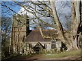
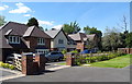
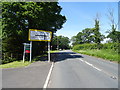
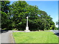
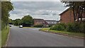
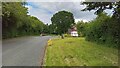
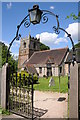
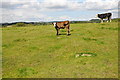


14 photos from this area
Area Information
Key information about the B98 8SG including its size, population, and administrative classification.
- Area Type
- Postcode
- Area Size
- 1.5 hectares
- Population
- 1059
- Population Density
- 1320 people/km²
House Prices in B98 8SG
21
Properties
£278,706
Average Sold Price
£110,000
Lowest Price
£390,000
Highest Price
Showing 21 properties
| Address | Type | Beds | Baths | Last Sale Price | Last Sale Date | |
|---|---|---|---|---|---|---|
| 6 Thornbury Lane, Redditch, B98 8SG | house | 3 | 2 | £387,466 | Aug 2024 | |
| 20 Thornbury Lane, Redditch, B98 8SG | house | - | - | £380,000 | Sep 2022 | |
| 38 Thornbury Lane, Redditch, B98 8SG | Bungalow | - | - | £335,000 | Mar 2021 | |
| 24 Thornbury Lane, Redditch, B98 8SG | house | - | - | £390,000 | Sep 2020 | |
| 8 Thornbury Lane, Redditch, B98 8SG | Detached | 3 | 2 | £322,000 | Dec 2019 | |
| 18 Thornbury Lane, Redditch, B98 8SG | Detached | 4 | 3 | £324,995 | Aug 2019 | |
| 32 Thornbury Lane, Redditch, B98 8SG | Detached | - | - | £365,000 | May 2019 | |
| 30 Thornbury Lane, Redditch, B98 8SG | Detached | 3 | - | £285,000 | May 2018 | |
| 40 Thornbury Lane, Redditch, B98 8SG | Bungalow | - | - | £315,000 | Feb 2018 | |
| 36 Thornbury Lane, Redditch, B98 8SG | Bungalow | 2 | - | £229,950 | Dec 2014 |
Page 1 of 3
Energy Efficiency in B98 8SG
Amenities
Schools
| Rank | School | Type | Entry gender | Ages |
|---|
Explore more schools in this area
Go to Schools tabDemographics
Household Size
Two person
most common
Accommodation Type
Houses
most common
Tenure
96
majority
Ethnic Group
White
most common
Religion
N/A
most common
Household Composition
N/A
most common
Age
47
median
Adults (30-64 years)
most common
Household Deprivation
N/A
with no deprivation
NS-SEC
44
in Lower managerial occupations
Explore more demographic insights in this area
Go to Demographics tabPlanning
Planning Constraints
- Flood RiskPremium
- Ramsar Wetland SitesPremium
- Area of Outstanding Natural BeautyPremium
- Protected Nature ReservePremium
- Protected WoodlandPremium