Area Overview for B98 7SL
Photos of B98 7SL
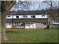
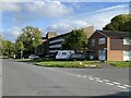
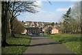

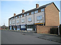
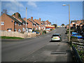
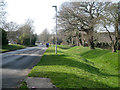
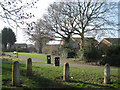
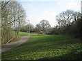
25 photos from this area
Area Information
Key information about the B98 7SL including its size, population, and administrative classification.
- Area Type
- Postcode
- Area Size
- 1.5 hectares
- Population
- 1371
- Population Density
- 8961 people/km²
House Prices in B98 7SL
64
Properties
£111,219
Average Sold Price
£37,000
Lowest Price
£290,000
Highest Price
Showing 64 properties
| Address | Type | Beds | Baths | Last Sale Price | Last Sale Date | |
|---|---|---|---|---|---|---|
| 74 Cropthorne Close, Redditch, B98 7SL | Flat | 1 | 1 | £95,000 | Apr 2025 | |
| 75 Cropthorne Close, Redditch, B98 7SL | Flat | 1 | 1 | £95,000 | Dec 2023 | |
| 88 Cropthorne Close, Redditch, B98 7SL | house | - | - | £185,000 | Nov 2022 | |
| 82 Cropthorne Close, Redditch, B98 7SL | house | - | - | £290,000 | Apr 2022 | |
| 90 Cropthorne Close, Redditch, B98 7SL | Semi-detached | 3 | - | £146,500 | Dec 2021 | |
| 99 Cropthorne Close, Redditch, B98 7SL | Terraced | 3 | - | £153,000 | Nov 2021 | |
| 104 Cropthorne Close, Redditch, B98 7SL | house | - | - | £143,000 | May 2020 | |
| 94 Cropthorne Close, Redditch, B98 7SL | Terraced | 3 | 1 | £135,000 | Feb 2019 | |
| 105 Cropthorne Close, Redditch, B98 7SL | Terraced | 3 | 1 | £120,000 | Mar 2017 | |
| 92 Cropthorne Close, Redditch, B98 7SL | Terraced | 4 | - | £80,000 | Nov 2012 |
Page 1 of 7
Energy Efficiency in B98 7SL
Amenities
Schools
| Rank | School | Type | Entry gender | Ages |
|---|
Explore more schools in this area
Go to Schools tabDemographics
Household Size
Family (3-5 people)
most common
Accommodation Type
Houses
most common
Tenure
40
majority
Ethnic Group
White
most common
Religion
N/A
most common
Household Composition
N/A
most common
Age
47
median
Adults (30-64 years)
most common
Household Deprivation
N/A
with no deprivation
NS-SEC
16
in Lower managerial occupations
Explore more demographic insights in this area
Go to Demographics tabPlanning
Planning Constraints
- Flood RiskPremium
- Ramsar Wetland SitesPremium
- Area of Outstanding Natural BeautyPremium
- Protected Nature ReservePremium
- Protected WoodlandPremium