Area Overview for B97 5RR
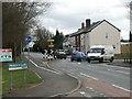
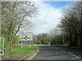
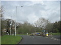
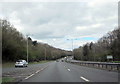
Photos of B97 5RR
Area Information
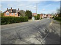
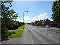
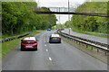
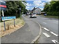
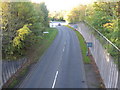
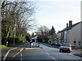
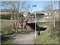
Living in B97 5RR means inhabiting a compact, semi-rural postcode area nestled west of Redditch’s town centre, encompassing parts of Webheath and Callow Hill. With a population of 1,599 spread across 2,352 square metres, the area is densely populated yet retains a suburban character. Historically, Callow Hill traces back to the 16th century, with cottages and a 19th-century windmill adding to its charm. Webheath, once a standalone parish, now blends into Redditch’s broader fabric. The area is defined by its proximity to villages like Batchley and Astwood Bank, and its transport links to major roads and rail networks. Daily life here balances rural tranquillity with access to urban amenities, from local pubs like The Rose and Crown to parks such as Morton Stanley Park, which originated from land donated by a factory owner in 1921. The mix of historic architecture and modern infrastructure makes it a distinctive place for those seeking a quieter lifestyle near larger towns.
- Area Type
- Postcode
- Area Size
- 2352 m²
- Population
- 1599
- Population Density
- 3662 people/km²
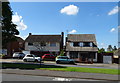
The property market in B97 5RR is characterised by a 68% home ownership rate, with houses forming the predominant accommodation type. This suggests a market skewed towards owner-occupation rather than rental properties, which is typical of suburban areas with established housing stock. The concentration of houses, rather than flats or apartments, indicates a preference for family homes, aligning with the area’s median age and demographic profile. However, the small size of the postcode area (2,352 m²) means the housing stock is limited, potentially making the market competitive for buyers. Proximity to Redditch’s urban core may also influence property values, offering a balance between rural seclusion and access to larger town amenities.
House Prices in B97 5RR
No properties found in this postcode.
Energy Efficiency in B97 5RR
The lifestyle in B97 5RR combines rural charm with suburban practicality. Residents can access retail options like Tesco Redditch, Spar, and Co-op Redditch, while the village hall on Foxholes Lane offers community spaces. Morton Stanley Park, a public green space from bequeathed farmland, provides recreational opportunities, and local pubs like The Rose and Crown serve as social hubs. The area’s semi-rural nature includes features like Callow Hill’s village pond and the historic St Philip’s Church. Proximity to rail stations and major roads ensures connectivity to nearby towns, while the low crime rate and flood risk contribute to a sense of security. This blend of amenities, history, and accessibility makes daily life both convenient and rooted in tradition.
Amenities
Schools
Residents of B97 5RR have access to several primary schools, including Webheath First School, Webheath Academy Primary School, and Our Lady of Mount Carmel Catholic First School, which operates both as a primary and academy. Lyndenwood is listed as an "other" school, though its specific role is unclear from the data. The presence of multiple primary schools suggests a strong local education network, though the absence of secondary schools may require families to travel to nearby towns. The mix of state and Catholic schools offers choice, but without Ofsted ratings or performance data, it is difficult to assess their quality. For families prioritising proximity to schools, this area provides several options within walking or short driving distance.
| Rank | School | Type | Entry gender | Ages |
|---|
Explore more schools in this area
Go to Schools tabDemographics
B97 5RR has a median age of 47, with the majority of residents aged 30–64, reflecting a mature, stable community. Home ownership stands at 68%, indicating a strong presence of long-term residents. The area is predominantly composed of houses, aligning with the demographic profile of families and professionals. The predominant ethnic group is White, with no data provided on other ethnicities. The high population density of 679,708 people per square kilometre suggests a compact, closely knit neighbourhood. This density, combined with the age range, implies a community focused on established living rather than transient populations. The lack of specific data on deprivation means quality of life is inferred from amenities like schools, transport, and low crime rates.
Household Size
Accommodation Type
Tenure
Ethnic Group
Religion
Household Composition
Age
Household Deprivation
NS-SEC
Explore more demographic insights in this area
Go to Demographics tabPlanning
Planning Constraints
- Flood RiskPremium
- Ramsar Wetland SitesPremium
- Area of Outstanding Natural BeautyPremium
- Protected Nature ReservePremium
- Protected WoodlandPremium