Area Overview for B97 5RW
Photos of B97 5RW
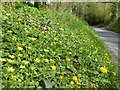
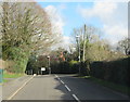
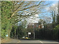
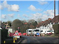
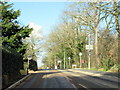
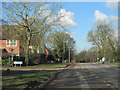
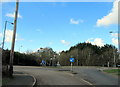
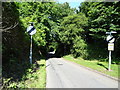
31 photos from this area
Area Information
Key information about the B97 5RW including its size, population, and administrative classification.
- Area Type
- Postcode
- Area Size
- 2.7 hectares
- Population
- 1599
- Population Density
- 3662 people/km²
House Prices in B97 5RW
49
Properties
£195,388
Average Sold Price
£59,950
Lowest Price
£382,000
Highest Price
Showing 49 properties
| Address | Type | Beds | Baths | Last Sale Price | Last Sale Date | |
|---|---|---|---|---|---|---|
| 61 Springvale Road, Redditch, B97 5RW | Detached | 2 | 1 | £280,000 | Dec 2025 | |
| 10 Springvale Road, Redditch, B97 5RW | Detached | 3 | 2 | £325,000 | Aug 2025 | |
| 34 Springvale Road, Redditch, B97 5RW | Bungalow | 1 | 1 | £185,000 | Mar 2025 | |
| 69 Springvale Road, Redditch, B97 5RW | Detached | 3 | 1 | £382,000 | Nov 2024 | |
| 2 Springvale Road, Redditch, B97 5RW | Detached | 3 | 2 | £330,000 | May 2024 | |
| 46 Springvale Road, Redditch, B97 5RW | Detached | 3 | 1 | £342,000 | Feb 2024 | |
| 14 Springvale Road, Redditch, B97 5RW | Detached | 3 | 1 | £377,500 | Mar 2023 | |
| 38 Springvale Road, Redditch, B97 5RW | house | - | - | £275,000 | Jun 2021 | |
| 36 Springvale Road, Redditch, B97 5RW | Bungalow | 1 | 1 | £145,000 | Sep 2020 | |
| 20 Springvale Road, Redditch, B97 5RW | Detached | 3 | 1 | £230,000 | Mar 2020 |
Page 1 of 5
Energy Efficiency in B97 5RW
Amenities
Schools
| Rank | School | Type | Entry gender | Ages |
|---|
Explore more schools in this area
Go to Schools tabDemographics
Household Size
Two person
most common
Accommodation Type
Houses
most common
Tenure
68
majority
Ethnic Group
White
most common
Religion
N/A
most common
Household Composition
N/A
most common
Age
47
median
Adults (30-64 years)
most common
Household Deprivation
N/A
with no deprivation
NS-SEC
33
in Lower managerial occupations
Explore more demographic insights in this area
Go to Demographics tabPlanning
Planning Constraints
- Flood RiskPremium
- Ramsar Wetland SitesPremium
- Area of Outstanding Natural BeautyPremium
- Protected Nature ReservePremium
- Protected WoodlandPremium