Area Overview for B97 4PA
Photos of B97 4PA
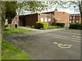
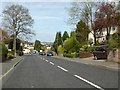
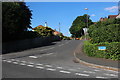
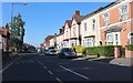
53 photos from this area
Area Information
Key information about the B97 4PA including its size, population, and administrative classification.
- Area Type
- Postcode
- Area Size
- 24.7 hectares
- Population
- 1404
- Population Density
- 1809 people/km²
House Prices in B97 4PA
32
Properties
£244,726
Average Sold Price
£69,950
Lowest Price
£480,000
Highest Price
Showing 32 properties
| Address | Type | Beds | Baths | Last Sale Price | Last Sale Date | |
|---|---|---|---|---|---|---|
| 128 Plymouth Road, Redditch, B97 4PA | Semi-detached | 3 | 1 | £281,000 | Jan 2025 | |
| 140 Plymouth Road, Redditch, B97 4PA | Detached | 4 | 2 | £480,000 | Dec 2024 | |
| 152 Plymouth Road, Redditch, B97 4PA | Semi-detached | 4 | 1 | £350,000 | Jan 2024 | |
| 126 Plymouth Road, Redditch, B97 4PA | Detached | 3 | 1 | £265,000 | Jan 2024 | |
| 148 Plymouth Road, Redditch, B97 4PA | Detached | 4 | 2 | £377,500 | Mar 2022 | |
| 132 Plymouth Road, Redditch, B97 4PA | Semi-detached | 3 | 1 | £265,000 | Nov 2021 | |
| 134 Plymouth Road, Redditch, B97 4PA | Semi-detached | 3 | 1 | £255,000 | Apr 2021 | |
| 122 Plymouth Road, Redditch, B97 4PA | Semi-detached | 3 | 1 | £247,500 | Mar 2021 | |
| 150 Plymouth Road, Redditch, B97 4PA | Semi-detached | - | - | £210,000 | Feb 2021 | |
| 170 Plymouth Road, Redditch, B97 4PA | house | 4 | 1 | £375,000 | Feb 2018 |
Page 1 of 4
Energy Efficiency in B97 4PA
Amenities
Schools
| Rank | School | Type | Entry gender | Ages |
|---|
Explore more schools in this area
Go to Schools tabDemographics
Household Size
Two person
most common
Accommodation Type
Houses
most common
Tenure
82
majority
Ethnic Group
White
most common
Religion
N/A
most common
Household Composition
N/A
most common
Age
47
median
Adults (30-64 years)
most common
Household Deprivation
N/A
with no deprivation
NS-SEC
35
in Lower managerial occupations
Explore more demographic insights in this area
Go to Demographics tabPlanning
Planning Constraints
- Flood RiskPremium
- Ramsar Wetland SitesPremium
- Area of Outstanding Natural BeautyPremium
- Protected Nature ReservePremium
- Protected WoodlandPremium