Area Overview for B97 4NZ
Photos of B97 4NZ
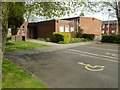
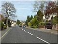
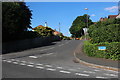
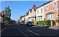
53 photos from this area
Area Information
Key information about the B97 4NZ including its size, population, and administrative classification.
- Area Type
- Postcode
- Area Size
- 2.9 hectares
- Population
- 1404
- Population Density
- 1809 people/km²
House Prices in B97 4NZ
30
Properties
£266,335
Average Sold Price
£80,000
Lowest Price
£551,050
Highest Price
Showing 30 properties
| Address | Type | Beds | Baths | Last Sale Price | Last Sale Date | |
|---|---|---|---|---|---|---|
| 119 Plymouth Road, Redditch, B97 4NZ | house | 3 | 1 | £270,000 | Sep 2025 | |
| 129 Plymouth Road, Redditch, B97 4NZ | Terraced | 3 | 1 | £330,000 | Mar 2025 | |
| 161 Plymouth Road, Redditch, B97 4NZ | Semi-detached | 4 | 2 | £340,000 | Mar 2024 | |
| 139 Plymouth Road, Redditch, B97 4NZ | house | 4 | 1 | £393,000 | Oct 2022 | |
| 131 Plymouth Road, Redditch, B97 4NZ | Retail | 3 | 1 | £360,000 | Oct 2022 | |
| 145 Plymouth Road, Redditch, B97 4NZ | Detached | 5 | 2 | £320,000 | May 2022 | |
| 149A Plymouth Road, Redditch, B97 4NZ | Detached | 5 | 3 | £551,050 | Mar 2022 | |
| 111 Plymouth Road, Redditch, B97 4NZ | Semi-detached | 3 | 1 | £255,000 | Mar 2021 | |
| 149 Plymouth Road, Redditch, B97 4NZ | house | - | - | £445,000 | Feb 2021 | |
| 123 Plymouth Road, Redditch, B97 4NZ | house | - | - | £230,000 | Jan 2021 |
Page 1 of 3
Energy Efficiency in B97 4NZ
Amenities
Schools
| Rank | School | Type | Entry gender | Ages |
|---|
Explore more schools in this area
Go to Schools tabDemographics
Household Size
Two person
most common
Accommodation Type
Houses
most common
Tenure
82
majority
Ethnic Group
White
most common
Religion
N/A
most common
Household Composition
N/A
most common
Age
47
median
Adults (30-64 years)
most common
Household Deprivation
N/A
with no deprivation
NS-SEC
35
in Lower managerial occupations
Explore more demographic insights in this area
Go to Demographics tabPlanning
Planning Constraints
- Flood RiskPremium
- Ramsar Wetland SitesPremium
- Area of Outstanding Natural BeautyPremium
- Protected Nature ReservePremium
- Protected WoodlandPremium