Area Overview for B94 5DP
Photos of B94 5DP


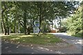
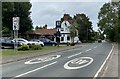
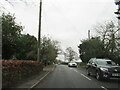
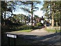
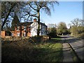
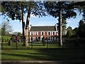
31 photos from this area
Area Information
Key information about the B94 5DP including its size, population, and administrative classification.
- Area Type
- Postcode
- Area Size
- 28.9 hectares
- Population
- 2042
- Population Density
- 161 people/km²
House Prices in B94 5DP
26
Properties
£690,682
Average Sold Price
£220,000
Lowest Price
£1,415,000
Highest Price
Showing 26 properties
| Address | Type | Beds | Baths | Last Sale Price | Last Sale Date | |
|---|---|---|---|---|---|---|
| Marvern, Broad Lane, Wood End, Tanworth In Arden, B94 5DP | Detached | 4 | 2 | £1,125,000 | Dec 2022 | |
| Church View, Broad Lane, Wood End, Tanworth In Arden, B94 5DP | house | - | - | £430,000 | Jan 2021 | |
| The Old Cottage, Broad Lane, Wood End, Tanworth In Arden, B94 5DP | house | - | - | £365,000 | May 2020 | |
| Edelweiss, Broad Lane, Wood End, Tanworth In Arden, B94 5DP | Detached | - | - | £650,000 | May 2019 | |
| Wellington House, Broad Lane, Wood End, Tanworth In Arden, B94 5DP | house | - | - | £1,415,000 | Apr 2019 | |
| Copperfield, Broad Lane, Wood End, Tanworth In Arden, B94 5DP | house | - | - | £1,200,000 | Sep 2017 | |
| Mulberry House, Broad Lane, Wood End, Tanworth In Arden, B94 5DP | Detached | 4 | - | £537,500 | Mar 2017 | |
| The Firs, Broad Lane, Wood End, Tanworth In Arden, B94 5DP | Detached | 6 | 2 | £815,000 | Mar 2016 | |
| Field Gate House, Broad Lane, Wood End, Tanworth In Arden, B94 5DP | house | 4 | - | £495,000 | Sep 2011 | |
| Orchard View, Broad Lane, Wood End, Tanworth In Arden, B94 5DP | house | - | - | £345,000 | Feb 2002 |
Page 1 of 3
Energy Efficiency in B94 5DP
Amenities
Schools
| Rank | School | Type | Entry gender | Ages |
|---|
Explore more schools in this area
Go to Schools tabDemographics
Household Size
Two person
most common
Accommodation Type
Houses
most common
Tenure
92
majority
Ethnic Group
White
most common
Religion
N/A
most common
Household Composition
N/A
most common
Age
47
median
Adults (30-64 years)
most common
Household Deprivation
N/A
with no deprivation
NS-SEC
45
in Lower managerial occupations
Explore more demographic insights in this area
Go to Demographics tabPlanning
Planning Constraints
- Flood RiskPremium
- Ramsar Wetland SitesPremium
- Area of Outstanding Natural BeautyPremium
- Protected Nature ReservePremium
- Protected WoodlandPremium