Area Overview for B93 9LP
Photos of B93 9LP
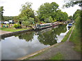
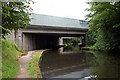
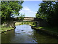
75 photos from this area
Area Information
Key information about the B93 9LP including its size, population, and administrative classification.
- Area Type
- Postcode
- Area Size
- 37.8 hectares
- Population
- 1658
- Population Density
- 592 people/km²
House Prices in B93 9LP
38
Properties
£663,184
Average Sold Price
£127,000
Lowest Price
£1,925,000
Highest Price
Showing 38 properties
| Address | Type | Beds | Baths | Last Sale Price | Last Sale Date | |
|---|---|---|---|---|---|---|
| 47 Jacobean Lane, Knowle, Solihull, B93 9LP | house | - | - | £420,000 | Jun 2024 | |
| 49 Jacobean Lane, Knowle, Solihull, B93 9LP | Terraced | 2 | 1 | £315,000 | May 2024 | |
| 30 Jacobean Lane, Knowle, Solihull, B93 9LP | Detached | 5 | 3 | £1,925,000 | Jul 2023 | |
| 55 Jacobean Lane, Knowle, Solihull, B93 9LP | house | - | - | £685,000 | Sep 2022 | |
| 53 Jacobean Lane, Knowle, Solihull, B93 9LP | house | - | - | £358,000 | Jul 2019 | |
| 17 Jacobean Lane, Knowle, Solihull, B93 9LP | Detached | 5 | - | £1,135,000 | May 2019 | |
| 20 Jacobean Lane, Knowle, Solihull, B93 9LP | house | - | - | £1,169,500 | Jan 2017 | |
| 57 Jacobean Lane, Knowle, Solihull, B93 9LP | house | - | - | £385,000 | Oct 2016 | |
| 61 Jacobean Lane, Knowle, Solihull, B93 9LP | house | 4 | 2 | £750,000 | Oct 2013 | |
| 33 Jacobean Lane, Knowle, Solihull, B93 9LP | house | 5 | - | £1,000,000 | May 2012 |
Page 1 of 4
Energy Efficiency in B93 9LP
Amenities
Schools
| Rank | School | Type | Entry gender | Ages |
|---|
Explore more schools in this area
Go to Schools tabDemographics
Household Size
Two person
most common
Accommodation Type
Houses
most common
Tenure
88
majority
Ethnic Group
White
most common
Religion
N/A
most common
Household Composition
N/A
most common
Age
47
median
Elderly (65+ years)
most common
Household Deprivation
N/A
with no deprivation
NS-SEC
55
in Lower managerial occupations
Explore more demographic insights in this area
Go to Demographics tabPlanning
Planning Constraints
- Flood RiskPremium
- Ramsar Wetland SitesPremium
- Area of Outstanding Natural BeautyPremium
- Protected Nature ReservePremium
- Protected WoodlandPremium