Area Overview for B93 9EY
Photos of B93 9EY
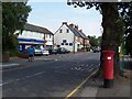
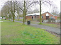


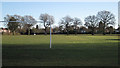
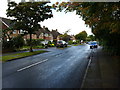
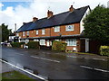

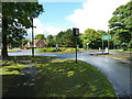
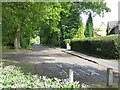
48 photos from this area
Area Information
Key information about the B93 9EY including its size, population, and administrative classification.
- Area Type
- Postcode
- Area Size
- 2.1 hectares
- Population
- 1531
- Population Density
- 1596 people/km²
House Prices in B93 9EY
18
Properties
£708,536
Average Sold Price
£229,500
Lowest Price
£1,115,000
Highest Price
Showing 18 properties
| Address | Type | Beds | Baths | Last Sale Price | Last Sale Date | |
|---|---|---|---|---|---|---|
| 32 Tilehouse Green Lane, Knowle, Solihull, B93 9EY | house | 6 | 4 | £1,025,000 | Jan 2025 | |
| 62 Tilehouse Green Lane, Knowle, Solihull, B93 9EY | house | - | - | £1,115,000 | Apr 2022 | |
| 34 Tilehouse Green Lane, Knowle, Solihull, B93 9EY | house | - | - | £920,000 | Jan 2021 | |
| 40 Tilehouse Green Lane, Knowle, Solihull, B93 9EY | Detached | 3 | 1 | £695,000 | Sep 2019 | |
| 56 Tilehouse Green Lane, Knowle, Solihull, B93 9EY | house | - | - | £855,000 | Nov 2016 | |
| 66 Tilehouse Green Lane, Knowle, Solihull, B93 9EY | house | - | - | £435,000 | Jan 2012 | |
| 60 Tilehouse Green Lane, Knowle, Solihull, B93 9EY | house | - | - | £665,000 | May 2008 | |
| 54 Tilehouse Green Lane, Knowle, Solihull, B93 9EY | Detached | - | - | £815,000 | Dec 2006 | |
| 36 Tilehouse Green Lane, Knowle, Solihull, B93 9EY | Detached | - | - | £895,000 | Jul 2005 | |
| 58 Tilehouse Green Lane, Knowle, Solihull, B93 9EY | Detached | - | - | £425,000 | Jun 2004 |
Page 1 of 2
Energy Efficiency in B93 9EY
Amenities
Schools
| Rank | School | Type | Entry gender | Ages |
|---|
Explore more schools in this area
Go to Schools tabDemographics
Household Size
Family (3-5 people)
most common
Accommodation Type
Houses
most common
Tenure
94
majority
Ethnic Group
White
most common
Religion
N/A
most common
Household Composition
N/A
most common
Age
47
median
Adults (30-64 years)
most common
Household Deprivation
N/A
with no deprivation
NS-SEC
56
in Lower managerial occupations
Explore more demographic insights in this area
Go to Demographics tabPlanning
Planning Constraints
- Flood RiskPremium
- Ramsar Wetland SitesPremium
- Area of Outstanding Natural BeautyPremium
- Protected Nature ReservePremium
- Protected WoodlandPremium