Area Overview for B93 9HT
Photos of B93 9HT
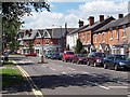
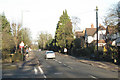
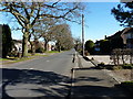
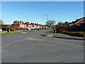
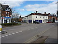
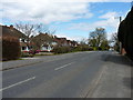
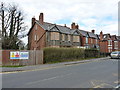
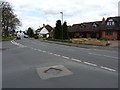
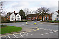

34 photos from this area
Area Information
Key information about the B93 9HT including its size, population, and administrative classification.
- Area Type
- Postcode
- Area Size
- 2.5 hectares
- Population
- 1635
- Population Density
- 865 people/km²
House Prices in B93 9HT
25
Properties
£320,420
Average Sold Price
£67,500
Lowest Price
£665,000
Highest Price
Showing 25 properties
| Address | Type | Beds | Baths | Last Sale Price | Last Sale Date | |
|---|---|---|---|---|---|---|
| 81 Longdon Road, Knowle, Solihull, B93 9HT | Semi-detached | 2 | 1 | £380,000 | Mar 2025 | |
| 63 Longdon Road, Knowle, Solihull, B93 9HT | house | - | - | £375,000 | Apr 2022 | |
| 61 Longdon Road, Knowle, Solihull, B93 9HT | house | - | - | £340,000 | Nov 2017 | |
| 79 Longdon Road, Knowle, Solihull, B93 9HT | house | - | - | £334,000 | Nov 2017 | |
| 97 Longdon Road, Knowle, Solihull, B93 9HT | house | 2 | 1 | £329,950 | Dec 2015 | |
| 95 Longdon Road, Knowle, Solihull, B93 9HT | Semi-detached | 3 | - | £300,000 | Sep 2015 | |
| 65 Longdon Road, Knowle, Solihull, B93 9HT | house | - | - | £339,950 | Sep 2015 | |
| 83 Longdon Road, Knowle, Solihull, B93 9HT | Semi-detached | 2 | - | £307,000 | Jun 2015 | |
| 85 Longdon Road, Knowle, Solihull, B93 9HT | house | - | - | £285,000 | Jun 2014 | |
| 77 Longdon Road, Knowle, Solihull, B93 9HT | house | 2 | - | £257,000 | Jun 2014 |
Page 1 of 3
Energy Efficiency in B93 9HT
Amenities
Schools
| Rank | School | Type | Entry gender | Ages |
|---|
Explore more schools in this area
Go to Schools tabDemographics
Household Size
One person
most common
Accommodation Type
Houses
most common
Tenure
61
majority
Ethnic Group
White
most common
Religion
N/A
most common
Household Composition
N/A
most common
Age
47
median
Adults (30-64 years)
most common
Household Deprivation
N/A
with no deprivation
NS-SEC
46
in Lower managerial occupations
Explore more demographic insights in this area
Go to Demographics tabPlanning
Planning Constraints
- Flood RiskPremium
- Ramsar Wetland SitesPremium
- Area of Outstanding Natural BeautyPremium
- Protected Nature ReservePremium
- Protected WoodlandPremium