Area Overview for B93 8SG
Photos of B93 8SG

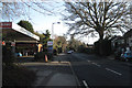
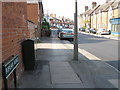
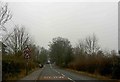
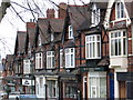
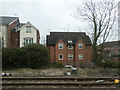
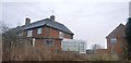
50 photos from this area
Area Information
Key information about the B93 8SG including its size, population, and administrative classification.
- Area Type
- Postcode
- Area Size
- 1.3 hectares
- Population
- 1484
- Population Density
- 444 people/km²
House Prices in B93 8SG
19
Properties
£578,307
Average Sold Price
£179,950
Lowest Price
£940,000
Highest Price
Showing 19 properties
| Address | Type | Beds | Baths | Last Sale Price | Last Sale Date | |
|---|---|---|---|---|---|---|
| 14 Althorpe Drive, Dorridge, Solihull, B93 8SG | house | 5 | 2 | £830,000 | Jul 2024 | |
| Squirrels Rest, 25 Althorpe Drive, Dorridge, Solihull, B93 8SG | Detached | 5 | - | £940,000 | Oct 2023 | |
| 26 Althorpe Drive, Dorridge, Solihull, B93 8SG | house | 5 | - | £940,000 | Jan 2023 | |
| 15 Althorpe Drive, Dorridge, Solihull, B93 8SG | Detached | 5 | - | £620,000 | Nov 2020 | |
| 8 Althorpe Drive, Dorridge, Solihull, B93 8SG | house | - | - | £835,000 | Oct 2020 | |
| 22 Althorpe Drive, Dorridge, Solihull, B93 8SG | Detached | 4 | - | £665,000 | Oct 2019 | |
| 18 Althorpe Drive, Dorridge, Solihull, B93 8SG | house | - | - | £760,150 | Oct 2017 | |
| 27 Althorpe Drive, Dorridge, Solihull, B93 8SG | house | - | - | £595,000 | Sep 2016 | |
| 20 Althorpe Drive, Dorridge, Solihull, B93 8SG | Detached | 5 | - | £705,000 | May 2016 | |
| 23 Althorpe Drive, Dorridge, Solihull, B93 8SG | Detached | 5 | - | £575,000 | Jul 2015 |
Page 1 of 2
Energy Efficiency in B93 8SG
Amenities
Schools
| Rank | School | Type | Entry gender | Ages |
|---|
Explore more schools in this area
Go to Schools tabDemographics
Household Size
Family (3-5 people)
most common
Accommodation Type
Houses
most common
Tenure
93
majority
Ethnic Group
White
most common
Religion
N/A
most common
Household Composition
N/A
most common
Age
47
median
Adults (30-64 years)
most common
Household Deprivation
N/A
with no deprivation
NS-SEC
57
in Lower managerial occupations
Explore more demographic insights in this area
Go to Demographics tabPlanning
Planning Constraints
- Flood RiskPremium
- Ramsar Wetland SitesPremium
- Area of Outstanding Natural BeautyPremium
- Protected Nature ReservePremium
- Protected WoodlandPremium