Area Overview for B92 8RW
Photos of B92 8RW

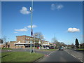
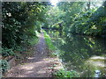


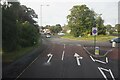
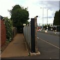
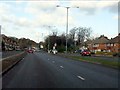
41 photos from this area
Area Information
Key information about the B92 8RW including its size, population, and administrative classification.
- Area Type
- Postcode
- Area Size
- 8059 m²
- Population
- 1487
- Population Density
- 4329 people/km²
House Prices in B92 8RW
17
Properties
£249,175
Average Sold Price
£120,000
Lowest Price
£410,000
Highest Price
Showing 17 properties
| Address | Type | Beds | Baths | Last Sale Price | Last Sale Date | |
|---|---|---|---|---|---|---|
| 151 Castle Lane, Olton, Solihull, B92 8RW | Semi-detached | 4 | 2 | £410,000 | Apr 2024 | |
| 157 Castle Lane, Olton, Solihull, B92 8RW | Semi-detached | 3 | 1 | £270,000 | Sep 2023 | |
| 153 Castle Lane, Olton, Solihull, B92 8RW | Semi-detached | 3 | 1 | £367,500 | Apr 2023 | |
| 132 Castle Lane, Olton, Solihull, B92 8RW | house | - | - | £295,000 | Jun 2022 | |
| 136 Castle Lane, Olton, Solihull, B92 8RW | Semi-detached | 3 | 1 | £229,000 | Sep 2018 | |
| 128A Castle Lane, Olton, Solihull, B92 8RW | Bungalow | - | - | £222,250 | Jul 2009 | |
| 140 Castle Lane, Olton, Solihull, B92 8RW | Semi-detached | - | - | £230,000 | Jun 2007 | |
| 155 Castle Lane, Olton, Solihull, B92 8RW | house | - | - | £193,000 | Nov 2004 | |
| 126 Castle Lane, Olton, Solihull, B92 8RW | Retirement | - | - | £155,000 | May 2003 | |
| 134 Castle Lane, Olton, Solihull, B92 8RW | Semi-detached | - | - | £120,000 | Jul 2002 |
Page 1 of 2
Energy Efficiency in B92 8RW
Amenities
Schools
| Rank | School | Type | Entry gender | Ages |
|---|
Explore more schools in this area
Go to Schools tabDemographics
Household Size
Two person
most common
Accommodation Type
Houses
most common
Tenure
73
majority
Ethnic Group
White
most common
Religion
N/A
most common
Household Composition
N/A
most common
Age
47
median
Adults (30-64 years)
most common
Household Deprivation
N/A
with no deprivation
NS-SEC
34
in Lower managerial occupations
Explore more demographic insights in this area
Go to Demographics tabPlanning
Planning Constraints
- Flood RiskPremium
- Ramsar Wetland SitesPremium
- Area of Outstanding Natural BeautyPremium
- Protected Nature ReservePremium
- Protected WoodlandPremium