Area Overview for B92 8TB
Photos of B92 8TB


Area Information
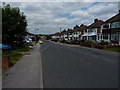
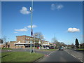
Living in B92 8TB means being part of a compact residential cluster in the West Midlands, nestled within the Metropolitan Borough of Solihull. With a population of 1,487, this postcode area is small but distinct, situated south of Coventry Road and bordered by Lode Lane and Hobs Moat Road. The area’s name, Lyndon, derives from Anglo-Saxon origins, reflecting its historical ties to a hill with a lime tree and the former Lyndon Manor, now Olton Jubilee Park. While the broader Lyndon ward has a population of around 13,728, B92 8TB represents a focused, residential microcosm. Daily life here blends urban convenience with local character, supported by nearby amenities like schools, pubs, and retail outlets. The area’s high population density and mix of socio-economic profiles create a community that balances accessibility to Solihull’s broader infrastructure with a sense of local identity. For homebuyers, B92 8TB offers proximity to transport networks, including rail links to Birmingham and the nearby Birmingham International Airport, while retaining the charm of a historically rooted neighbourhood.
- Area Type
- Postcode
- Area Size
- Not available
- Population
- 1487
- Population Density
- 4329 people/km²
The property market in B92 8TB is defined by a high proportion of owner-occupied homes, with 73% of properties in private hands. The accommodation type is predominantly houses, indicating a focus on family-friendly or semi-detached housing stock. Given the area’s small size, the housing options are limited to this specific cluster, which may appeal to buyers seeking a compact, residential environment. The concentration of homes in this postcode suggests a mature market with established properties, though the lack of larger-scale development could mean fewer new builds or modern housing options. For buyers, this means prioritising properties within the immediate vicinity, where the mix of houses and the proximity to amenities like schools and transport links may outweigh the limitations of a smaller area. The market’s character is shaped by its blend of traditional housing and the area’s historical roots, offering a distinct alternative to more sprawling developments.
House Prices in B92 8TB
No properties found in this postcode.
Energy Efficiency in B92 8TB
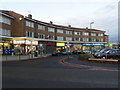
The lifestyle in B92 8TB is shaped by its proximity to a range of amenities. Local shops such as Tesco Hobs, Asda Hobs, and Co-op Lyndon provide daily essentials, while nearby pubs and Olton Jubilee Park—once the site of Lyndon Manor—offer recreational spaces. The area’s historical ties are evident in landmarks like Hob’s Moat, an ancient monument, and Hatchford Brook, adding a layer of local character. The presence of rail stations and Birmingham International Airport ensures easy access to broader destinations, supporting both leisure and commuting needs. For residents, the blend of urban convenience and small-town charm means a balance between accessibility and a sense of community. The compact nature of the area means amenities are close at hand, though the limited size may require residents to venture slightly further for more specialised services or larger retail options.
Amenities
Schools
The schools nearest to B92 8TB include St Andrew’s Catholic Primary School, listed twice in the data. Both entries confirm the presence of a primary school in the area, though no secondary schools are mentioned. For families with young children, this provides a local option for primary education, though parents may need to consider travel for secondary schooling. The duplication of the school’s name in the data may reflect administrative details rather than multiple institutions. While the Ofsted rating is not provided, the existence of a primary school suggests a focus on early education within the community. The absence of secondary schools nearby could influence decisions about proximity to other educational hubs or commuting arrangements.
| Rank | School | Type | Entry gender | Ages |
|---|
Explore more schools in this area
Go to Schools tabDemographics
The community in B92 8TB is predominantly composed of adults aged 30–64, with a median age of 47. Home ownership rates stand at 73%, reflecting a strong presence of owner-occupied properties, with houses being the primary accommodation type. The area’s demographic profile is largely shaped by its White population, which accounts for 76% of residents, though 24% identify as ethnic minorities—a figure that has grown significantly since 2011, driven mainly by Asian and Asian British communities. The ward ranks in the 49th percentile nationally for deprivation, aligning with England’s average but falling below much of Solihull. This suggests a mix of socio-economic conditions, with some residents facing challenges in access to services or employment opportunities. Despite this, the area’s stability is underscored by its established residential character and the presence of local amenities that cater to both long-standing and newer residents.
Household Size
Accommodation Type
Tenure
Ethnic Group
Religion
Household Composition
Age
Household Deprivation
NS-SEC
Explore more demographic insights in this area
Go to Demographics tabPlanning
Planning Constraints
- Flood RiskPremium
- Ramsar Wetland SitesPremium
- Area of Outstanding Natural BeautyPremium
- Protected Nature ReservePremium
- Protected WoodlandPremium