Area Overview for B92 7EP
Photos of B92 7EP
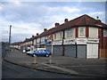
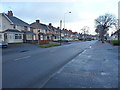
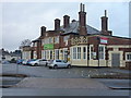
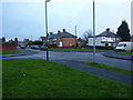
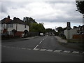
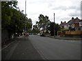
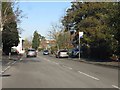
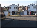
17 photos from this area
Area Information
Key information about the B92 7EP including its size, population, and administrative classification.
- Area Type
- Postcode
- Area Size
- 2.0 hectares
- Population
- 1944
- Population Density
- 4915 people/km²
House Prices in B92 7EP
61
Properties
£166,654
Average Sold Price
£94,000
Lowest Price
£231,887
Highest Price
Showing 61 properties
| Address | Type | Beds | Baths | Last Sale Price | Last Sale Date | |
|---|---|---|---|---|---|---|
| 78 Mickleton Road, Olton, Solihull, B92 7EP | Maisonette | 2 | 1 | £178,000 | Jul 2025 | |
| 74 Mickleton Road, Olton, Solihull, B92 7EP | Maisonette | 2 | 1 | £170,000 | Mar 2025 | |
| 55 Mickleton Road, Olton, Solihull, B92 7EP | Semi-detached | 2 | 1 | £186,000 | Mar 2024 | |
| 88 Mickleton Road, Olton, Solihull, B92 7EP | house | - | - | £231,887 | Apr 2022 | |
| 67 Mickleton Road, Olton, Solihull, B92 7EP | house | 2 | 1 | £145,000 | May 2018 | |
| 61 Mickleton Road, Olton, Solihull, B92 7EP | Terraced | 2 | - | £142,000 | Oct 2016 | |
| 73 Mickleton Road, Olton, Solihull, B92 7EP | Maisonette | 2 | 1 | £128,000 | Mar 2016 | |
| 90 Mickleton Road, Olton, Solihull, B92 7EP | house | - | - | £225,000 | May 2014 | |
| 57 Mickleton Road, Olton, Solihull, B92 7EP | Terraced | - | - | £94,000 | Feb 2005 | |
| 15, Windsor Lodge, Mickleton Road, Olton, Solihull, B92 7EP | Flat | 1 | 1 | - | - |
Page 1 of 7
Energy Efficiency in B92 7EP
Amenities
Schools
| Rank | School | Type | Entry gender | Ages |
|---|
Explore more schools in this area
Go to Schools tabDemographics
Household Size
One person
most common
Accommodation Type
Flats
most common
Tenure
46
majority
Ethnic Group
White
most common
Religion
N/A
most common
Household Composition
N/A
most common
Age
47
median
Adults (30-64 years)
most common
Household Deprivation
N/A
with no deprivation
NS-SEC
31
in Lower managerial occupations
Explore more demographic insights in this area
Go to Demographics tabPlanning
Planning Constraints
- Flood RiskPremium
- Ramsar Wetland SitesPremium
- Area of Outstanding Natural BeautyPremium
- Protected Nature ReservePremium
- Protected WoodlandPremium