Area Overview for B27 7AF
Photos of B27 7AF
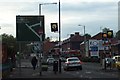
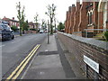
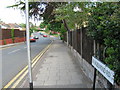

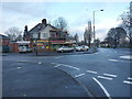
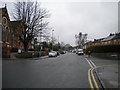
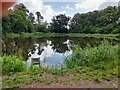
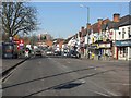
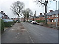
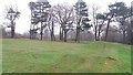
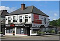
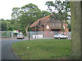
17 photos from this area
Area Information
Key information about the B27 7AF including its size, population, and administrative classification.
- Area Type
- Postcode
- Area Size
- 4.5 hectares
- Population
- 1944
- Population Density
- 4915 people/km²
House Prices in B27 7AF
65
Properties
£184,361
Average Sold Price
£109,000
Lowest Price
£316,000
Highest Price
Showing 65 properties
| Address | Type | Beds | Baths | Last Sale Price | Last Sale Date | |
|---|---|---|---|---|---|---|
| 166 Dorsington Road, Olton, Solihull, B27 7AF | Terraced | 3 | 1 | £251,000 | Sep 2025 | |
| 156 Dorsington Road, Olton, Solihull, B27 7AF | house | 5 | 6 | £174,000 | Jun 2025 | |
| 83 Dorsington Road, Olton, Solihull, B27 7AF | house | - | - | £207,000 | Nov 2024 | |
| 146 Dorsington Road, Olton, Solihull, B27 7AF | Terraced | 2 | 1 | £180,000 | Jul 2024 | |
| 137 Dorsington Road, Olton, Solihull, B27 7AF | Maisonette | - | - | £113,500 | Jun 2024 | |
| 107 Dorsington Road, Olton, Solihull, B27 7AF | Terraced | 3 | 1 | £195,000 | Nov 2023 | |
| 85 Dorsington Road, Olton, Solihull, B27 7AF | Terraced | 3 | 1 | £210,000 | Dec 2022 | |
| 81 Dorsington Road, Olton, Solihull, B27 7AF | house | - | - | £316,000 | Jul 2022 | |
| 93 Dorsington Road, Olton, Solihull, B27 7AF | Retail | 3 | - | £276,000 | Mar 2022 | |
| 91 Dorsington Road, Olton, Solihull, B27 7AF | Terraced | 2 | 1 | £180,000 | Jan 2022 |
Page 1 of 7
Energy Efficiency in B27 7AF
Amenities
Schools
| Rank | School | Type | Entry gender | Ages |
|---|
Explore more schools in this area
Go to Schools tabDemographics
Household Size
One person
most common
Accommodation Type
Flats
most common
Tenure
46
majority
Ethnic Group
White
most common
Religion
N/A
most common
Household Composition
N/A
most common
Age
47
median
Adults (30-64 years)
most common
Household Deprivation
N/A
with no deprivation
NS-SEC
31
in Lower managerial occupations
Explore more demographic insights in this area
Go to Demographics tabPlanning
Planning Constraints
- Flood RiskPremium
- Ramsar Wetland SitesPremium
- Area of Outstanding Natural BeautyPremium
- Protected Nature ReservePremium
- Protected WoodlandPremium