Area Overview for B91 3HR
Photos of B91 3HR
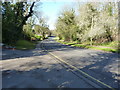
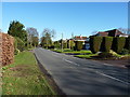
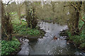
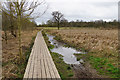
44 photos from this area
Area Information
Key information about the B91 3HR including its size, population, and administrative classification.
- Area Type
- Postcode
- Area Size
- 3.4 hectares
- Population
- 1658
- Population Density
- 592 people/km²
House Prices in B91 3HR
42
Properties
£324,771
Average Sold Price
£210,000
Lowest Price
£750,000
Highest Price
Showing 42 properties
| Address | Type | Beds | Baths | Last Sale Price | Last Sale Date | |
|---|---|---|---|---|---|---|
| 47 Riverside Drive, Solihull, B91 3HR | Flat | 3 | 2 | £320,000 | Aug 2025 | |
| 69 Riverside Drive, Solihull, B91 3HR | Flat | 3 | 1 | £365,000 | Aug 2025 | |
| 44 Riverside Drive, Solihull, B91 3HR | Flat | 3 | 1 | £320,000 | Jun 2024 | |
| 62 Riverside Drive, Solihull, B91 3HR | Flat | 3 | 1 | £360,000 | Jan 2024 | |
| 59 Riverside Drive, Solihull, B91 3HR | Flat | - | - | £335,000 | Jul 2023 | |
| 45 Riverside Drive, Solihull, B91 3HR | Flat | - | - | £374,500 | Oct 2022 | |
| 70 Riverside Drive, Solihull, B91 3HR | Flat | - | - | £330,000 | Jul 2022 | |
| 81 Riverside Drive, Solihull, B91 3HR | Flat | 2 | 1 | £450,000 | May 2022 | |
| 78 Riverside Drive, Solihull, B91 3HR | Flat | - | - | £550,000 | Feb 2021 | |
| 49 Riverside Drive, Solihull, B91 3HR | Flat | - | - | £315,000 | Sep 2020 |
Page 1 of 5
Energy Efficiency in B91 3HR
Amenities
Schools
| Rank | School | Type | Entry gender | Ages |
|---|
Explore more schools in this area
Go to Schools tabDemographics
Household Size
Two person
most common
Accommodation Type
Houses
most common
Tenure
88
majority
Ethnic Group
White
most common
Religion
N/A
most common
Household Composition
N/A
most common
Age
47
median
Elderly (65+ years)
most common
Household Deprivation
N/A
with no deprivation
NS-SEC
55
in Lower managerial occupations
Explore more demographic insights in this area
Go to Demographics tabPlanning
Planning Constraints
- Flood RiskPremium
- Ramsar Wetland SitesPremium
- Area of Outstanding Natural BeautyPremium
- Protected Nature ReservePremium
- Protected WoodlandPremium