Area Overview for B91 2SS
Photos of B91 2SS
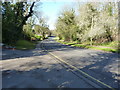
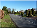
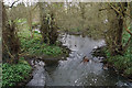
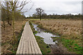
44 photos from this area
Area Information
Key information about the B91 2SS including its size, population, and administrative classification.
- Area Type
- Postcode
- Area Size
- 8.5 hectares
- Population
- 1658
- Population Density
- 592 people/km²
House Prices in B91 2SS
16
Properties
£494,421
Average Sold Price
£269,950
Lowest Price
£880,000
Highest Price
Showing 16 properties
| Address | Type | Beds | Baths | Last Sale Price | Last Sale Date | |
|---|---|---|---|---|---|---|
| 7 Gentleshaw Lane, Solihull, B91 2SS | Detached | 5 | 3 | £640,000 | Jul 2021 | |
| 2 Gentleshaw Lane, Solihull, B91 2SS | house | 5 | 3 | £593,000 | Feb 2018 | |
| 9 Gentleshaw Lane, Solihull, B91 2SS | Detached | 3 | - | £441,000 | Jun 2012 | |
| 17 Gentleshaw Lane, Solihull, B91 2SS | Detached | 4 | - | £295,000 | Apr 2012 | |
| 1 Gentleshaw Lane, Solihull, B91 2SS | Detached | 4 | - | £880,000 | Nov 2011 | |
| 19 Gentleshaw Lane, Solihull, B91 2SS | Bungalow | 5 | 2 | £342,000 | May 2007 | |
| 15 Gentleshaw Lane, Solihull, B91 2SS | Detached | - | - | £269,950 | Dec 2002 | |
| 11 Gentleshaw Lane, Solihull, B91 2SS | Detached | 4 | 1 | - | - | |
| 3 Gentleshaw Lane, Solihull, B91 2SS | Detached | 4 | 2 | - | - | |
| 14 Gentleshaw Lane, Solihull, B91 2SS | Detached | 4 | 1 | - | - |
Page 1 of 2
Energy Efficiency in B91 2SS
Amenities
Schools
| Rank | School | Type | Entry gender | Ages |
|---|
Explore more schools in this area
Go to Schools tabDemographics
Household Size
Two person
most common
Accommodation Type
Houses
most common
Tenure
88
majority
Ethnic Group
White
most common
Religion
N/A
most common
Household Composition
N/A
most common
Age
47
median
Elderly (65+ years)
most common
Household Deprivation
N/A
with no deprivation
NS-SEC
55
in Lower managerial occupations
Explore more demographic insights in this area
Go to Demographics tabPlanning
Planning Constraints
- Flood RiskPremium
- Ramsar Wetland SitesPremium
- Area of Outstanding Natural BeautyPremium
- Protected Nature ReservePremium
- Protected WoodlandPremium