Area Overview for B91 2RZ
Photos of B91 2RZ

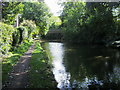
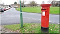
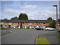
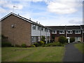
48 photos from this area
Area Information
Key information about the B91 2RZ including its size, population, and administrative classification.
- Area Type
- Postcode
- Area Size
- 1.0 hectares
- Population
- 2199
- Population Density
- 6454 people/km²
House Prices in B91 2RZ
42
Properties
£155,521
Average Sold Price
£45,750
Lowest Price
£415,000
Highest Price
Showing 42 properties
| Address | Type | Beds | Baths | Last Sale Price | Last Sale Date | |
|---|---|---|---|---|---|---|
| 165 Wharf Lane, Solihull, B91 2RZ | Flat | 2 | 1 | £87,500 | Feb 2025 | |
| 187 Wharf Lane, Solihull, B91 2RZ | Terraced | 3 | 2 | £310,000 | May 2024 | |
| 219 Wharf Lane, Solihull, B91 2RZ | Flat | 2 | 1 | £155,000 | Apr 2024 | |
| 223 Wharf Lane, Solihull, B91 2RZ | Flat | - | - | £185,000 | Feb 2024 | |
| 173 Wharf Lane, Solihull, B91 2RZ | Flat | 2 | 1 | £125,000 | Dec 2023 | |
| 181 Wharf Lane, Solihull, B91 2RZ | Detached | 3 | 2 | £415,000 | Jul 2023 | |
| 193 Wharf Lane, Solihull, B91 2RZ | Flat | - | - | £78,250 | Apr 2022 | |
| 163 Wharf Lane, Solihull, B91 2RZ | Flat | 2 | 1 | £154,000 | Mar 2022 | |
| 191 Wharf Lane, Solihull, B91 2RZ | Terraced | 3 | 3 | £272,500 | Aug 2021 | |
| 227 Wharf Lane, Solihull, B91 2RZ | Flat | - | - | £177,000 | May 2021 |
Page 1 of 5
Energy Efficiency in B91 2RZ
Amenities
Schools
| Rank | School | Type | Entry gender | Ages |
|---|
Explore more schools in this area
Go to Schools tabDemographics
Household Size
One person
most common
Accommodation Type
Houses
most common
Tenure
53
majority
Ethnic Group
White
most common
Religion
N/A
most common
Household Composition
N/A
most common
Age
47
median
Adults (30-64 years)
most common
Household Deprivation
N/A
with no deprivation
NS-SEC
33
in Lower managerial occupations
Explore more demographic insights in this area
Go to Demographics tabPlanning
Planning Constraints
- Flood RiskPremium
- Ramsar Wetland SitesPremium
- Area of Outstanding Natural BeautyPremium
- Protected Nature ReservePremium
- Protected WoodlandPremium