Area Overview for B91 2LF
Photos of B91 2LF
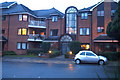
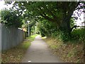
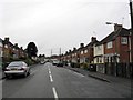
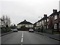
100 photos from this area
Area Information
Key information about the B91 2LF including its size, population, and administrative classification.
- Area Type
- Postcode
- Area Size
- 1.9 hectares
- Population
- 1824
- Population Density
- 3646 people/km²
House Prices in B91 2LF
73
Properties
£165,517
Average Sold Price
£72,500
Lowest Price
£260,000
Highest Price
Showing 73 properties
| Address | Type | Beds | Baths | Last Sale Price | Last Sale Date | |
|---|---|---|---|---|---|---|
| 69 Wharf Lane, Solihull, B91 2LF | Flat | 2 | 2 | £170,000 | Oct 2025 | |
| 23 Wharf Lane, Solihull, B91 2LF | house | - | - | £185,000 | Jul 2024 | |
| 31 Wharf Lane, Solihull, B91 2LF | Flat | - | - | £133,000 | Apr 2024 | |
| 59 Wharf Lane, Solihull, B91 2LF | Flat | - | - | £160,000 | Mar 2023 | |
| 27 Wharf Lane, Solihull, B91 2LF | Flat | 2 | 1 | £162,000 | Sep 2022 | |
| 39 Wharf Lane, Solihull, B91 2LF | Flat | - | - | £147,000 | Feb 2022 | |
| 17 Wharf Lane, Solihull, B91 2LF | Semi-detached | 3 | 2 | £260,000 | Mar 2021 | |
| 49 Wharf Lane, Solihull, B91 2LF | Semi-detached | 3 | 2 | £120,000 | Oct 2019 | |
| 65 Wharf Lane, Solihull, B91 2LF | Flat | - | - | £154,000 | Sep 2017 | |
| 5 Wharf Lane, Solihull, B91 2LF | Maisonette | - | - | £171,000 | Aug 2017 |
Page 1 of 8
Energy Efficiency in B91 2LF
Amenities
Schools
| Rank | School | Type | Entry gender | Ages |
|---|
Explore more schools in this area
Go to Schools tabDemographics
Household Size
Family (3-5 people)
most common
Accommodation Type
Houses
most common
Tenure
65
majority
Ethnic Group
White
most common
Religion
N/A
most common
Household Composition
N/A
most common
Age
47
median
Adults (30-64 years)
most common
Household Deprivation
N/A
with no deprivation
NS-SEC
41
in Lower managerial occupations
Explore more demographic insights in this area
Go to Demographics tabPlanning
Planning Constraints
- Flood RiskPremium
- Ramsar Wetland SitesPremium
- Area of Outstanding Natural BeautyPremium
- Protected Nature ReservePremium
- Protected WoodlandPremium