Area Overview for B91 2PD
Photos of B91 2PD
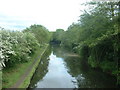
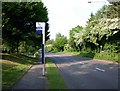
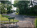
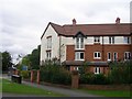
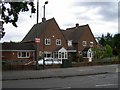
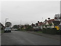


53 photos from this area
Area Information
Key information about the B91 2PD including its size, population, and administrative classification.
- Area Type
- Postcode
- Area Size
- 1.6 hectares
- Population
- 1886
- Population Density
- 713 people/km²
House Prices in B91 2PD
19
Properties
£410,273
Average Sold Price
£110,000
Lowest Price
£705,000
Highest Price
Showing 19 properties
| Address | Type | Beds | Baths | Last Sale Price | Last Sale Date | |
|---|---|---|---|---|---|---|
| 33 Yew Tree Lane, Solihull, B91 2PD | Detached | 6 | 2 | £705,000 | Jul 2020 | |
| 58 Yew Tree Lane, Solihull, B91 2PD | Detached | 8 | 2 | £525,000 | Dec 2018 | |
| 68 Yew Tree Lane, Solihull, B91 2PD | house | - | - | £425,000 | Jun 2018 | |
| 32 Yew Tree Lane, Solihull, B91 2PD | Detached | 4 | 3 | £640,000 | Dec 2017 | |
| 37 Yew Tree Lane, Solihull, B91 2PD | house | - | - | £440,000 | Sep 2017 | |
| 70 Yew Tree Lane, Solihull, B91 2PD | Detached | 3 | 2 | £385,000 | Sep 2015 | |
| 66 Yew Tree Lane, Solihull, B91 2PD | house | - | - | £410,000 | Oct 2011 | |
| 31 Yew Tree Lane, Solihull, B91 2PD | Detached | - | - | £415,000 | Dec 2007 | |
| 39 Yew Tree Lane, Solihull, B91 2PD | Bungalow | 3 | 2 | £220,000 | Aug 2002 | |
| 41 Yew Tree Lane, Solihull, B91 2PD | house | - | - | £238,000 | Jul 2001 |
Page 1 of 2
Energy Efficiency in B91 2PD
Amenities
Schools
| Rank | School | Type | Entry gender | Ages |
|---|
Explore more schools in this area
Go to Schools tabDemographics
Household Size
Two person
most common
Accommodation Type
Houses
most common
Tenure
86
majority
Ethnic Group
White
most common
Religion
N/A
most common
Household Composition
N/A
most common
Age
47
median
Adults (30-64 years)
most common
Household Deprivation
N/A
with no deprivation
NS-SEC
49
in Lower managerial occupations
Explore more demographic insights in this area
Go to Demographics tabPlanning
Planning Constraints
- Flood RiskPremium
- Ramsar Wetland SitesPremium
- Area of Outstanding Natural BeautyPremium
- Protected Nature ReservePremium
- Protected WoodlandPremium