Area Overview for B91 2NX
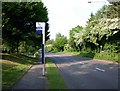
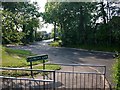
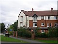
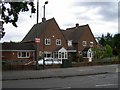
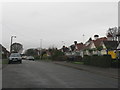
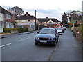
Photos of B91 2NX


Area Information
The postcode B91 2NX defines a small, tightly knit residential cluster within the wider Solihull landscape. This specific area covers just 3,354 square metres, yet it supports a population of 1,886 people, resulting in a density of 713 people per square kilometre. Located in the Silhill Ward of the Metropolitan Borough of Solihull, the neighbourhood sits near key junctions like Streetsbrook Road and Broad Oaks Road. Although the area is defined by a specific postcode, its history is woven into the wider local story. The vicinity was historically home to Silhill Hall, a half-timbered manor originally built in the 13th century. Despite the demolition of this historic landmark in 1966, the area retains a connection to its past as part of a ward that has existed for centuries. Living in B91 2NX means residing in a distinct pocket of the West Midlands where modern infrastructure meets long-standing local tradition. The compact nature of this postcode suggests close proximity for its residents, fostering a sense of community within a concentrated footprint. The ward contains approximately 1,798 people according to electoral records, which aligns closely with the population figures associated with the B91 2NX cluster. This concentration indicates that daily life for homeowners here involves being surrounded by neighbours and local services within a short distance. While the area may not be massive by city standards, its location near major transport arteries like the A38 provides access to the wider region without sacrificing the benefits of a specific residential zone. The history of the area, marked by the ownership of Solihull Hall by families such as the Odingsells and Gough, adds a layer of character to the streets where you might choose to buy a home. For those considering moving, understanding the scale of B91 2NX is crucial. It is not a sprawling suburban expanse but a defined cluster with a clear population centre. The area's identity is tied to its location in the outer borough of Solihull, benefiting from the infrastructure of the wider metropolitan area while maintaining its own statistical profile. The demographic makeup, with a median age of 47, suggests a mature community where established residents have lived in their homes for decades. This stability often translates into well-maintained properties and a predictable environment for new arrivals. The area's size and population density work together to create a neighbourhood that feels accessible and integrated into the broader Solihull fabric, offering a balance of privacy and community engagement.
- Area Type
- Postcode
- Area Size
- 3354 m²
- Population
- 1886
- Population Density
- 713 people/km²
The property market in B91 2NX is characterised by a strong owner-occupier base. With 86% of households owning their homes, the area functions primarily as an investment for long-term residents rather than a hub for short-term rentals or buy-to-let schemes. This high level of ownership typically correlates with well-kept properties, as owners are motivated to maintain their investment. The accommodation type in this cluster is predominantly houses, which aligns with the northern and western suburbs of Solihull where family-sized homes are standard. Buying in this specific postcode means entering a market where neighbours are likely to have been in their homes for many years, leading to steady property prices and a sense of exclusion from sudden market volatility. For those looking at homes in B91 2NX, the implication of having 86% owner occupancy is clear: you will find a stock of properties that have been carefully tended over generations. The typical home here is a house, offering gardens and private living spaces that are less common in high-density urban blocks. This housing type supports the local demographic, where the median age of 47 reflects families who prioritised space and comfort for their children. The small size of the postcode, covering only 3,354 square metres, means that supply is limited. This scarcity can drive up the value of individual properties, as there are fewer alternative options within this specific boundary. Buyers considering this area should note that the market is not dominated by new-build apartments or conversion projects. Instead, it relies on the existing stock of houses that have served the community for decades. The high ownership rate suggests that resale markets tend to move slower but with more careful vetting, as sellers are often motivated to stay in their homes for the long term. This creates a predictable environment for transactions, free from the rapid turnover often seen in student accommodation zones. The focus remains on traditional family homes that match the demographic needs of local families. The area's status within the Silhill Ward ensures that it benefits from the broader Solihull market dynamics without being subject to the niche pricing of rural pockets or heavy urban regenerations.
House Prices in B91 2NX
Showing 9 properties
| Address | Type | Beds | Baths | Last Sale Price | Last Sale Date | |
|---|---|---|---|---|---|---|
| 57A Yew Tree Lane, Solihull, B91 2NX | Flat | - | - | £150,000 | Feb 2017 | |
| 47 Yew Tree Lane, Solihull, B91 2NX | house | 3 | - | £224,500 | Dec 2011 | |
| 59A Yew Tree Lane, Solihull, B91 2NX | Flat | - | - | £78,000 | Jun 1997 | |
| 49A Yew Tree Lane, Solihull, B91 2NX | Flat | 1 | 1 | - | - | |
| 55 Yew Tree Lane, Solihull, B91 2NX | Detached | - | - | - | - | |
| 63A Yew Tree Lane, Solihull, B91 2NX | Flat | - | - | - | - | |
| 45 Yew Tree Lane, Solihull, B91 2NX | Semi-detached | - | - | - | - | |
| 53A Yew Tree Lane, Solihull, B91 2NX | Flat | - | - | - | - | |
| 55A Yew Tree Lane, Solihull, B91 2NX | Flat | 1 | 1 | - | - |
Energy Efficiency in B91 2NX
Residents of B91 2NX enjoy access to a variety of amenities within practical reach, balancing daily needs with leisure. For shopping, there are five retail options nearby, including Tesco Lode, Morrisons Solihull, and Sainsburys Solihull. These stores provide comprehensive access to groceries and household essentials, reducing the need for long errands. Commuters will find five railway connections within reach, specifically Solihull Railway Station, Widney Manor Railway Station, and Olton Railway Station. These stations offer frequent services to the broader West Midlands network, making travel to Birmingham or Coventry routine. For those requiring air travel, Birmingham International Airport and Birmingham International Railway Station are also accessible, linking the residential area to global destinations. The lifestyle in this postcode is defined by convenience and easy access to established commercial hubs. Living near Tesco Lode and Morrisons Solihull means that daily shopping trips can be completed in minutes. The presence of multiple supermarket chains indicates a competitive and well-stocked retail environment. Families can access fresh produce, pantry staples, and household goods without travelling far from their homes in B91 2NX. The proximity of these amenities supports the active lifestyle of many residents, who may prefer walking or cycling short distances for routine purchases. The variety of retail and transport options ensures that daily life is not interrupted by a lack of services or long commutes. Leisure and transport options combine to create a rounded local experience. While the immediate postcode area is residential, the surrounding Solihull borough offers parks and leisure centres that are reachable within minutes. The railway connections to Widney Manor and Olton provide a link to local leisure facilities and green spaces. For residents who work from home, the excellent broadband supports leisure activities such as online gaming or streaming, complementing the quality of local retail. The ability to access an airport nearby means that short breaks away from the area are equally feasible. This blend of retail, transport, and leisure options makes B91 2NX a well-served location for those who value time-efficiency in their daily routine.
Amenities
Schools
Families living in or near B91 2NX have access to two primary schools within the cluster. Yew Tree Primary School serves the immediate area, providing education essentials for young children in the neighbourhood. Slightly further along, Tudor Grange Primary Academy Yew Tree holds a Good rating from Ofsted, indicating a school that performs well against national standards. Both institutions are primary schools, catering to children from the early years up to ages eight or nine. This mix means that parents entering the education system can choose between two established local options without needing to travel far beyond their postcode boundary. The presence of these schools supports the demographic profile of the area, where the majority of residents are adults between 30 and 64 years old. Many households in B91 2NX likely have children attending either Yew Tree Primary School or Tudor Grange Primary Academy. The Good rating from Ofsted for one of the schools adds a layer of confidence for prospective parents. It suggests that the academic environment meets high standards, which is a key consideration for families with school-age children. The location of these schools near the residential cluster means that pupils from B91 2NX walk or catch a school bus to classes without requiring lengthy commutes. For families moving to the area, the proximity of primary education is a significant benefit. The concentration of primary rather than secondary schools in the immediate vicinity suggests that the community is geared towards younger children. Parents may need to look elsewhere for secondary education, but the local primary options provide a strong foundation. The availability of these schools reinforces the area's appeal to families seeking a suburban lifestyle with easy access to schooling. The names Yew Tree and Tudor Grange become part of the local geography, familiar to any child growing up in the postcode. Both schools contribute to the educational fabric of the Silhill Ward, ensuring that residents have established institutions nearby.
| Rank | School | Type | Entry gender | Ages |
|---|
Explore more schools in this area
Go to Schools tabDemographics
The community within B91 2NX reflects a mature and stable population, with a median age of 47 years. The majority of residents fall into the 30 to 64 years age range, indicating an area settled by working-age families and those approaching retirement. This age profile suggests a neighbourhood where children may have already moved on to further education or careers, while younger residents remain connected to the area. Home ownership is the dominant form of tenure, with 86% of households owning their property outright or with a mortgage. This high rate of ownership points to a community invested in the local area and likely involved in its long-term maintenance and development. Accommodation in B91 2NX consists primarily of houses, rather than flats or high-density apartments. This housing type supports the family-oriented demographic and aligns with the preference for single-family living found in the wider Silhill Ward. The population is overwhelmingly White, reflecting the traditional demographic composition of much of the West Midlands region. There is no significant data suggesting a rapidly diversifying population in this specific postcode, reinforcing the image of a settled, homogenous community. The area's specific population of 1,886 people within its 3,354 square metre footprint creates a density where neighbours know one another, yet individual homes retain privacy. For homebuyers, the 86% ownership rate is a significant statistic. It implies that the local estate and economic interests are heavily tied to property value appreciation rather than rental turnover. The housing stock, consisting mainly of houses, caters to families seeking space and stability. The demographic consistency suggests that services and amenities will cater to the needs of adults with dependent children or driving-age youths. While the area is not the youngest in England, the 30-64 year old bracket provides a strong economic base to support local businesses. The absence of a large student or young professional demographic means the area operates less like a university town and more like a conventional suburban residential zone. This stability makes it an attractive location for those seeking a quiet afternoons and a permanent home setting.
Household Size
Accommodation Type
Tenure
Ethnic Group
Religion
Household Composition
Age
Household Deprivation
NS-SEC
Explore more demographic insights in this area
Go to Demographics tabPlanning
Planning Constraints
- Flood RiskPremium
- Ramsar Wetland SitesPremium
- Area of Outstanding Natural BeautyPremium
- Protected Nature ReservePremium
- Protected WoodlandPremium