Area Overview for B91 2JA
Photos of B91 2JA

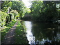
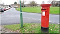
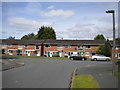
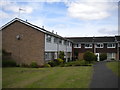
48 photos from this area
Area Information
Key information about the B91 2JA including its size, population, and administrative classification.
- Area Type
- Postcode
- Area Size
- 1.0 hectares
- Population
- 1613
- Population Density
- 1675 people/km²
House Prices in B91 2JA
26
Properties
£160,150
Average Sold Price
£59,950
Lowest Price
£245,000
Highest Price
Showing 26 properties
| Address | Type | Beds | Baths | Last Sale Price | Last Sale Date | |
|---|---|---|---|---|---|---|
| 19 Ratcliffe Road, Solihull, B91 2JA | Terraced | 3 | 1 | £245,000 | Oct 2020 | |
| 21 Ratcliffe Road, Solihull, B91 2JA | Terraced | 3 | 1 | £175,000 | Jun 2016 | |
| 23 Ratcliffe Road, Solihull, B91 2JA | Terraced | 3 | 1 | £195,000 | Oct 2015 | |
| 8 Ratcliffe Road, Solihull, B91 2JA | house | 4 | - | £163,500 | Jan 2015 | |
| 7 Ratcliffe Road, Solihull, B91 2JA | Semi-detached | 4 | 2 | £187,000 | Jul 2013 | |
| 2 Ratcliffe Road, Solihull, B91 2JA | Terraced | 3 | 1 | £160,000 | Jun 2013 | |
| 3 Ratcliffe Road, Solihull, B91 2JA | house | 4 | 4 | £157,500 | Jun 2013 | |
| 25 Ratcliffe Road, Solihull, B91 2JA | Terraced | 3 | - | £148,000 | Mar 2013 | |
| 22 Ratcliffe Road, Solihull, B91 2JA | Terraced | 2 | 1 | £129,500 | Dec 2011 | |
| 15 Ratcliffe Road, Solihull, B91 2JA | Terraced | - | - | £170,000 | Apr 2005 |
Page 1 of 3
Energy Efficiency in B91 2JA
Amenities
Schools
| Rank | School | Type | Entry gender | Ages |
|---|
Explore more schools in this area
Go to Schools tabDemographics
Household Size
Family (3-5 people)
most common
Accommodation Type
Houses
most common
Tenure
79
majority
Ethnic Group
White
most common
Religion
N/A
most common
Household Composition
N/A
most common
Age
47
median
Adults (30-64 years)
most common
Household Deprivation
N/A
with no deprivation
NS-SEC
35
in Lower managerial occupations
Explore more demographic insights in this area
Go to Demographics tabPlanning
Planning Constraints
- Flood RiskPremium
- Ramsar Wetland SitesPremium
- Area of Outstanding Natural BeautyPremium
- Protected Nature ReservePremium
- Protected WoodlandPremium