Area Overview for B92 8NW
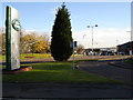
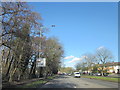
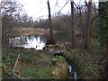
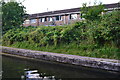
Photos of B92 8NW


Area Information
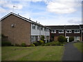
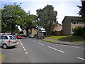
Living in B92 8NW means inhabiting a compact, residential cluster in Elmdon, a small parish in Solihull, West Midlands. The area covers 21.7 hectares, housing 1,613 people in a densely populated 7,428 people per square kilometre. This is a place of historical and practical significance, shaped by its proximity to Birmingham International Airport, which opened in 1939. The parish, once a medieval manor, has evolved into a community with a median age of 47, dominated by adults aged 30–64. Daily life here is defined by proximity to transport hubs and green spaces. Elmdon Park, established on the grounds of the former Elmdon Hall, offers a legacy of natural beauty, though its edges have been encroached by housing and industry. The area’s compact size means residents are within walking or short driving distance of key amenities, from shops to rail links. With 79% of homes owner-occupied, it’s a stable, family-oriented neighbourhood, where the past of ironmasters and anti-slavery campaigners coexists with the modern rhythms of regional aviation.
- Area Type
- Postcode
- Area Size
- 21.7 hectares
- Population
- 1613
- Population Density
- 1675 people/km²
The property market in B92 8NW is characterised by high home ownership (79%) and a predominance of houses, which suggests a focus on owner-occupied, family homes. Given the area’s small size—21.7 hectares—the housing stock is limited, making it a niche market with potentially higher competition among buyers. The presence of houses rather than flats or apartments indicates a suburban or semi-rural setting, which may appeal to those seeking space and privacy. However, the proximity to Birmingham International Airport, which opened in 1939, could influence property values, with some properties potentially benefiting from the airport’s economic activity while others might face noise or visibility concerns. Buyers should consider the area’s compact nature, which means immediate surroundings are critical. The high home ownership rate also implies a stable market with fewer rental properties, which could be advantageous for those seeking long-term investment but less so for those requiring flexibility.
House Prices in B92 8NW
No properties found in this postcode.
Energy Efficiency in B92 8NW
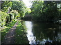
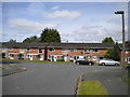
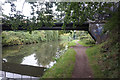
Residents of B92 8NW enjoy a mix of retail, transport, and green spaces within practical reach. Local shops include Tesco Hobs, Asda Hobs, and Cook Solihull, providing everyday convenience. Rail stations such as Olton, Solihull, and Acocks Green offer direct links to Birmingham and beyond, while Birmingham International Airport is a short distance away, enhancing travel options. Elmdon Park, a local nature reserve established on the grounds of the former Elmdon Hall, offers a legacy of natural beauty, though its edges have been affected by housing and industry. The park remains a focal point for leisure, with historical significance tied to Edith Holden’s documentation of its wildflowers. This blend of retail, transport, and green space creates a lifestyle that balances practicality with access to nature, making daily life both convenient and rooted in the area’s historical character.
Amenities
Schools
Residents of B92 8NW have access to a range of educational institutions, including Damson Wood Nursery and Infant School, a primary school with an Ofsted rating of ‘good’, and Bright Stars School, a special school catering to specific educational needs. The presence of both a primary and a special school indicates a diverse educational landscape, which can be beneficial for families with children of varying requirements. Damson Wood’s academy status and good rating suggest a reliable, well-regarded primary education option, while Bright Stars provides tailored support for students with special needs. This combination ensures that families can find schooling that aligns with their child’s needs without needing to travel far. The proximity of these schools to the area reinforces its appeal as a family-friendly neighbourhood, where educational infrastructure is accessible and varied.
| Rank | School | Type | Entry gender | Ages |
|---|
Explore more schools in this area
Go to Schools tabDemographics
The community in B92 8NW is predominantly composed of adults aged 30–64, with a median age of 47. This suggests a mature, established population, likely with long-term ties to the area. Home ownership is high at 79%, indicating a stable housing market and a preference for private residence over rental properties. The accommodation type is primarily houses, reflecting a suburban or semi-rural character. The predominant ethnic group is White, which aligns with broader demographic trends in the West Midlands. The population density of 7,428 people per square kilometre is exceptionally high for a residential area, which may influence the sense of community and the availability of private space. While no specific deprivation data is provided, the high home ownership and age profile suggest a relatively affluent or stable demographic, though the density could imply limited green space per household. This mix of factors creates a tightly knit, mature community with strong local ties.
Household Size
Accommodation Type
Tenure
Ethnic Group
Religion
Household Composition
Age
Household Deprivation
NS-SEC
Explore more demographic insights in this area
Go to Demographics tabPlanning
Planning Constraints
- Flood RiskPremium
- Ramsar Wetland SitesPremium
- Area of Outstanding Natural BeautyPremium
- Protected Nature ReservePremium
- Protected WoodlandPremium