Area Overview for B91 2DD
Photos of B91 2DD
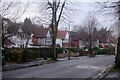
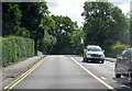
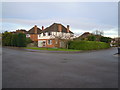
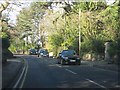
20 photos from this area
Area Information
Key information about the B91 2DD including its size, population, and administrative classification.
- Area Type
- Postcode
- Area Size
- 4693 m²
- Population
- 1671
- Population Density
- 2847 people/km²
House Prices in B91 2DD
14
Properties
£166,960
Average Sold Price
£66,000
Lowest Price
£300,000
Highest Price
Showing 14 properties
| Address | Type | Beds | Baths | Last Sale Price | Last Sale Date | |
|---|---|---|---|---|---|---|
| 4 Chadley Close, Solihull, B91 2DD | Flat | 2 | 1 | £215,000 | Apr 2024 | |
| 6 Chadley Close, Solihull, B91 2DD | Flat | 2 | 1 | £195,450 | Aug 2021 | |
| 12 Chadley Close, Solihull, B91 2DD | Flat | - | - | £131,250 | Jun 2020 | |
| 7 Chadley Close, Solihull, B91 2DD | Flat | 2 | 1 | £239,500 | Mar 2019 | |
| 10 Chadley Close, Solihull, B91 2DD | Flat | - | - | £220,000 | Sep 2018 | |
| 2 Chadley Close, Solihull, B91 2DD | Flat | - | - | £179,825 | Apr 2018 | |
| 14 Chadley Close, Solihull, B91 2DD | Bungalow | 2 | 1 | £300,000 | Feb 2016 | |
| 1 Chadley Close, Solihull, B91 2DD | Flat | - | - | £157,500 | Mar 2008 | |
| 11 Chadley Close, Solihull, B91 2DD | Flat | 2 | 1 | £108,000 | Aug 2003 | |
| 9 Chadley Close, Solihull, B91 2DD | Flat | - | - | £130,950 | May 2003 |
Page 1 of 2
Energy Efficiency in B91 2DD
Amenities
Schools
| Rank | School | Type | Entry gender | Ages |
|---|
Explore more schools in this area
Go to Schools tabDemographics
Household Size
Family (3-5 people)
most common
Accommodation Type
Houses
most common
Tenure
92
majority
Ethnic Group
White
most common
Religion
N/A
most common
Household Composition
N/A
most common
Age
47
median
Adults (30-64 years)
most common
Household Deprivation
N/A
with no deprivation
NS-SEC
55
in Lower managerial occupations
Explore more demographic insights in this area
Go to Demographics tabPlanning
Planning Constraints
- Flood RiskPremium
- Ramsar Wetland SitesPremium
- Area of Outstanding Natural BeautyPremium
- Protected Nature ReservePremium
- Protected WoodlandPremium