Area Overview for B91 2AG
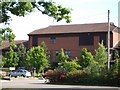
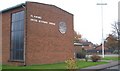
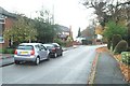
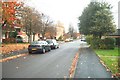
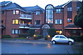
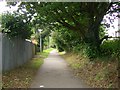
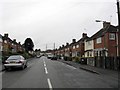
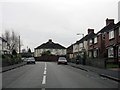
Photos of B91 2AG
Area Information
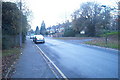
B91 2AG is a specific postcode area defining a small residential cluster within the Metropolitan Borough of Solihull. This location covers 1449 m² and houses a population of 1740. Residents live in a neighbourhood centred historically around Silhill Hall, a half-timbered manor that stood near Streetsbrook Road and Broad Oaks Road for nearly 700 years before its demolition in 1966. The area represents the Silhill Ward, an established community with deep historical roots dating back to the 13th century. You will find yourself in a setting where modern life intersects with significant local heritage. The population density here is high at 1200544 people/km², reflecting the compact nature of this specific postcode. Living in B91 2AG means accessing a community where the past is visibly documented in local history records while you navigate daily life in a developed zone. The area is situated in the West Midlands region, offering a distinct sense of place separate from the wider urban sprawl of Birmingham.
- Area Type
- Postcode
- Area Size
- 1449 m²
- Population
- 1740
- Population Density
- 2235 people/km²
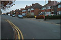
The property market in B91 2AG is defined by high levels of ownership and a specific housing stock type. You should expect to find flats as the predominant accommodation form within this postcode. This contrasts with areas dominated by detached or semi-detached houses. With 65% of households being owner-occupied, the local market is driven by residents who maintain a long-term stake in their homes. This majority ownership rate often results in a stable tenant pool for any private rentals that do exist, though the market skews heavily toward ownership. When searching for homes in B91 2AG, you will likely encounter a cluster of living spaces designed for smaller footprints rather than expansive family estates. The high population density within just 1449 m² supports this model of compact living. For buyers, this means the area functions primarily as an owner-occupied environment rather than a speculative rental zone. The specific mix of flats suggests a layout that maximises space efficiency suitable for the area's density. Understanding this dominance of flats and owner-occupiers provides a clear view of the assets available in this small, defined zone.
House Prices in B91 2AG
No properties found in this postcode.
Energy Efficiency in B91 2AG
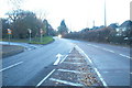
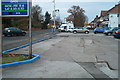
Living in B91 2AG offers practical access to retail and transport hubs within a short practical reach. You can walk or drive easily to Tesco Lode, Sainsburys Solihull, and the larger Tesco Solihull supermarket for your weekly shopping. For travel connections, five major train stations serve the area, including Solihull Railway Station, Widney Manor Railway Station, and Olton Railway Station. Further afield, Birmingham International Airport and Birmingham Intl Railway Station are accessible metro options for regional and international travel. This combination of local grocery stores and major rail links means you do not need to travel far for essential needs or commute to London and other cities. The lifestyle here is defined by these specific, named venues rather than vague generic descriptions. Residents benefit from having high-street retail options combined with primary rail interchange points on their doorstep. This convenience makes daily errands straightforward while maintaining easy access to wider regional networks.
Amenities
Schools
Families considering B91 2AG will have access to several independent educational institutions in the immediate vicinity. The nearest schools include Al-Furqan Solihull, Solihull School, Ruckleigh School, and Al-Furqan Community College (Boys). All four of these establishments are listed as independent schools, offering a range of private education options for residents. None of the listed facilities appear within the standard state-funded system based on the provided data. This concentration of independent schools suggests an area where families value private education or may have specific faith-based requirements, given the religious names of some institutions. There are no state comprehensive schools referenced for this specific postcode cluster. If you are looking for schools near B91 2AG, you must look beyond this immediate neighbourhood to the wider Solihull area for state alternatives. The presence of these specific independent colleges defines the primary educational landscape accessible directly to those living in this residential cluster.
| Rank | School | Type | Entry gender | Ages |
|---|
Explore more schools in this area
Go to Schools tabDemographics
The community composition of B91 2AG reflects a mature demographic profile. The median age in the area is 47 years old, indicating a population composed largely of adults. The most common age range among residents consists of the elderly, specifically those aged 65 years and over. Home ownership stands at 65%, meaning a strong majority of households own their properties outright or with a mortgage. This level of ownership suggests stability within the local community. The predominant ethnic group is White, forming the largest demographic cohort in this postcode. Regarding housing stock, the data identifies flats as the primary accommodation type. This structural preference aligns with the high density and design of the residential cluster you are considering. Approximately two-thirds of residents are owners, which typically influences the character of the development and the relationship between neighbours. Understanding these figures helps you assess the likely neighbour profile and the long-term nature of the settlement. The age profile and ownership rate together paint a picture of an established, settled community rather than a transient rental hub.
Household Size
Accommodation Type
Tenure
Ethnic Group
Religion
Household Composition
Age
Household Deprivation
NS-SEC
Explore more demographic insights in this area
Go to Demographics tabPlanning
Planning Constraints
- Flood RiskPremium
- Ramsar Wetland SitesPremium
- Area of Outstanding Natural BeautyPremium
- Protected Nature ReservePremium
- Protected WoodlandPremium