Area Overview for B91 1SQ
Photos of B91 1SQ
Area Information
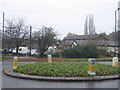
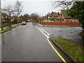
The postcode B91 1SQ sits within a small residential cluster that forms part of the historic core of Solihull town. This specific location covers an area of 1,699 square metres and serves a population of 1,687 people. Living in B91 1SQ means being located in St Alphege Ward, a planned medieval settlement founded between 1170 and 1180 by the de Limsey family as a free burgage borough. The area is centred near coordinates 52.416641, -1.801421 and lies close to the historic St Alphege Church at the head of High Street. This ward marks the town's formation as a trade hub around 1220, with the church established shortly after to serve the community. By 1242, the Manor of Solihull had a royal charter for a weekly market and annual fair on St Alphege's days. You are stepping into an 800-year-old environment where modern life intersects with a medieval foundation. The density of the population reflects a traditional, established neighbourhood rather than a sprawling suburb. Daily life here is characterised by proximity to the historic core while maintaining access to the wider facilities of Solihull.
- Area Type
- Postcode
- Area Size
- 1699 m²
- Population
- 1687
- Population Density
- 2733 people/km²
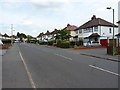
The property market in B91 1SQ is dominated by private ownership. With a home ownership rate of 95% for the 1,687 residents in this 1,699 square metre cluster, the local housing stock consists almost entirely of owner-occupied properties. This significantly reduces the presence of short-term rentals or buy-to-let investments that often characterise other high-density urban zones. The data confirms that the accommodation type throughout B91 1SQ comprises houses, not apartments or flats. Consequently, the market feels stable and residential rather than transactional or transient. For buyers looking for homes in B91 1SQ, the expectation should be of a traditional family environment where neighbours are likely to stay for long periods. The high ownership percentage suggests that the local economy relies on equity rather than speculative rental yields. You will find a market driven by residents with a personal stake in their street. This stability is a defining feature of the local real estate landscape, offering security that is rare in areas with higher rental turnover.
House Prices in B91 1SQ
Showing 2 properties
| Address | Type | Beds | Baths | Last Sale Price | Last Sale Date | |
|---|---|---|---|---|---|---|
| 15 White House Way, Solihull, B91 1SQ | Detached | - | - | £432,500 | Jul 2009 | |
| 11 White House Way, Solihull, B91 1SQ | Detached | - | - | - | - |
Energy Efficiency in B91 1SQ
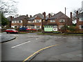
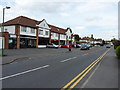
Daily life in B91 1SQ benefits from immediate access to a variety of amenities located within practical reach. You are close to five retail outlets, making straightforward shopping convenient. Notable supermarkets include Waitrose Solihull, Aldi Homer, and Tesco Solihull, ensuring you can find major grocery chains nearby. For those travelling further afield, five rail stations provide robust connections, with Solihull Railway Station being the most prominent locally. If you need air travel or major hub connections, Birmingham International Airport and Birmingham International Railway Station offer seamless metro-style access to the wider region. The area is situated near St Alphege Church, which stands at the head of High Street and serves as a central landmark. You can also find St Helen's Church nearby, which originated in new housing near Warwick Road and Seven Star Road. These facilities create a functional environment where essential services are just steps away from your home.
Amenities
Schools
| Rank | School | Type | Entry gender | Ages |
|---|
Explore more schools in this area
Go to Schools tabDemographics
The community within B91 1SQ is defined by a stable and mature demographic profile. The median age for residents is 47 years, placing the average householder firmly within the 30 to 64-year-old bracket. This age range represents the most common group living in the area, indicating a neighbourhood made up of established families and long-term residents. Home ownership stands at an exceptionally high 95%, meaning that the vast majority of the 1,687 people living here own their properties outright. This contrasts sharply with high streets reliant on short-term tenancies; B91 1SQ is a neighbourhood of permanent settlement. The predominant ethnic group is White, reflecting the traditional character of this historic ward. Accommodation types are almost exclusively houses, consistent with the median age and ownership figures. This demographic structure suggests a quiet, settled environment where residents have deep roots in the community. You are looking at an area where change is gradual and neighbourhood bonds tend to be strong over decades rather than years.
Household Size
Accommodation Type
Tenure
Ethnic Group
Religion
Household Composition
Age
Household Deprivation
NS-SEC
Explore more demographic insights in this area
Go to Demographics tabPlanning
Planning Constraints
- Flood RiskPremium
- Ramsar Wetland SitesPremium
- Area of Outstanding Natural BeautyPremium
- Protected Nature ReservePremium
- Protected WoodlandPremium