Area Overview for B91 1SP
Photos of B91 1SP
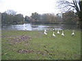
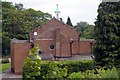
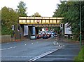
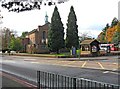
88 photos from this area
Area Information
Key information about the B91 1SP including its size, population, and administrative classification.
- Area Type
- Postcode
- Area Size
- 2.3 hectares
- Population
- 1798
- Population Density
- 1383 people/km²
House Prices in B91 1SP
31
Properties
£297,479
Average Sold Price
£152,500
Lowest Price
£876,000
Highest Price
Showing 31 properties
| Address | Type | Beds | Baths | Last Sale Price | Last Sale Date | |
|---|---|---|---|---|---|---|
| 48 White House Green, Solihull, B91 1SP | Flat | - | - | £227,500 | Mar 2024 | |
| 61 White House Green, Solihull, B91 1SP | Flat | - | - | £272,000 | Dec 2023 | |
| 36 White House Green, Solihull, B91 1SP | Flat | - | - | £261,000 | Dec 2023 | |
| 49 White House Green, Solihull, B91 1SP | Flat | - | - | £222,000 | Dec 2023 | |
| 30 White House Green, Solihull, B91 1SP | Flat | - | - | £237,500 | Sep 2021 | |
| 45 White House Green, Solihull, B91 1SP | Flat | - | - | £230,000 | Jan 2021 | |
| 32 White House Green, Solihull, B91 1SP | Flat | 2 | 1 | £242,000 | Aug 2019 | |
| 16 White House Green, Solihull, B91 1SP | Bungalow | - | - | £876,000 | Aug 2019 | |
| 38 White House Green, Solihull, B91 1SP | Flat | - | - | £230,000 | Apr 2019 | |
| 42 White House Green, Solihull, B91 1SP | Flat | - | - | £250,000 | Sep 2018 |
Page 1 of 4
Energy Efficiency in B91 1SP
Amenities
Schools
| Rank | School | Type | Entry gender | Ages |
|---|
Explore more schools in this area
Go to Schools tabDemographics
Household Size
One person
most common
Accommodation Type
Flats
most common
Tenure
66
majority
Ethnic Group
White
most common
Religion
N/A
most common
Household Composition
N/A
most common
Age
47
median
Adults (30-64 years)
most common
Household Deprivation
N/A
with no deprivation
NS-SEC
55
in Lower managerial occupations
Explore more demographic insights in this area
Go to Demographics tabPlanning
Planning Constraints
- Flood RiskPremium
- Ramsar Wetland SitesPremium
- Area of Outstanding Natural BeautyPremium
- Protected Nature ReservePremium
- Protected WoodlandPremium