Area Overview for B90 3AF
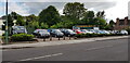
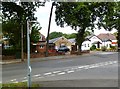
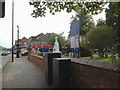
Photos of B90 3AF


Area Information
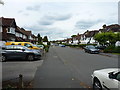
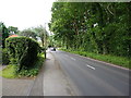
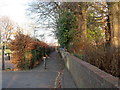
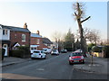
Living in B90 3AF means inhabiting a compact residential cluster within the Shirley area of Solihull, a suburb with roots tracing back to the 13th century. The postcode covers 1,533 square metres, housing 1,247 people in a densely populated setting. Positioned 3 miles southeast of Solihull town centre along Stratford Road, the area benefits from proximity to major transport routes like the M42 motorway and Stratford Road, a former turnpike. Historically a farming settlement, Shirley West evolved into a residential suburb during the 1920s-30s, with post-war developments like the Cranmore estate shaping its current character. While less affluent than some surrounding areas, it avoids the extremes of deprivation seen in Shirley East. Residents enjoy a mix of local amenities, schools, and transport links, making it a practical choice for those prioritising connectivity over sprawling green spaces.
- Area Type
- Postcode
- Area Size
- 1533 m²
- Population
- 1247
- Population Density
- 3497 people/km²
The property market in B90 3AF is characterised by a high rate of home ownership (73%), with houses forming the majority of the accommodation stock. This suggests a market skewed towards owner-occupied properties rather than rentals, likely attracting buyers seeking stability and long-term investment. The small area size and limited housing stock mean the market is not expansive, but proximity to transport links like the M42 and Stratford Road may enhance property appeal. For buyers, the focus is on individual homes rather than apartments or shared spaces, aligning with the area’s traditional residential character. Those considering the area should prioritise proximity to amenities and schools, as the small footprint limits options for expansion or development.
House Prices in B90 3AF
No properties found in this postcode.
Energy Efficiency in B90 3AF
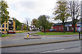
The lifestyle in B90 3AF is shaped by its proximity to retail, rail, and transport hubs. Local shops include Iceland Shirley, Aldi Shirley, and M&S Stratford Rd Solihull BP, offering everyday essentials. Rail stations like Shirley Railway Station and Yardley Wood provide links to Birmingham and surrounding areas, while Birmingham International Airport is a short journey away. Though the area lacks extensive parks or leisure facilities, its strategic location along Stratford Road and near the M42 ensures easy access to broader recreational opportunities. The mix of retail and transport options supports a practical, convenience-driven lifestyle, ideal for those prioritising accessibility over expansive green spaces.
Amenities
Schools
Residents of B90 3AF have access to a range of educational institutions, including St James Church of England Voluntary Aided Junior School, a primary school with no Ofsted rating specified, and Tudor Grange Primary Academy, St James, which holds an outstanding Ofsted rating. For independent education, Kingswood School offers a good Ofsted rating. The mix of state and independent schools provides families with choice, though the absence of secondary school data means parents may need to look beyond the immediate area for older children’s education. The presence of a highly rated primary school is a strong draw for families prioritising early education quality.
| Rank | School | Type | Entry gender | Ages |
|---|
Explore more schools in this area
Go to Schools tabDemographics
The population of B90 3AF has a median age of 47, with the majority of residents aged 30-64 years. This suggests a community skewed towards middle-aged adults, likely including professionals and families. Home ownership stands at 73%, with houses being the predominant accommodation type, indicating a stable, long-term resident base. The predominant ethnic group is White, reflecting broader trends in the area. While no specific deprivation data is provided, the area is noted as less prosperous than some neighbouring parts of Solihull but avoids the higher deprivation levels in Shirley East. This demographic profile implies a community focused on established living, with fewer transient residents compared to more diverse or younger areas.
Household Size
Accommodation Type
Tenure
Ethnic Group
Religion
Household Composition
Age
Household Deprivation
NS-SEC
Explore more demographic insights in this area
Go to Demographics tabPlanning
Planning Constraints
- Flood RiskPremium
- Ramsar Wetland SitesPremium
- Area of Outstanding Natural BeautyPremium
- Protected Nature ReservePremium
- Protected WoodlandPremium