Area Overview for B90 2LY
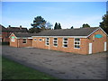
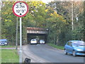
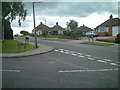
Photos of B90 2LY


Area Information
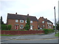
Living in B90 2LY means being part of a compact, densely populated residential cluster in the heart of Shirley West, Solihull. The area covers just 1,194 m² yet hosts 1,569 residents, creating a tightly knit community. Historically a farming settlement, it now lies 3 miles southeast of Solihull town centre along Stratford Road, with easy access to the M42 motorway. The area’s character is defined by its urban residential layout, with a focus on houses rather than flats, reflecting a mature demographic. With a median age of 47, the population skews toward adults aged 30–64, suggesting a stable, established community. The high home ownership rate (82%) indicates long-term residency, though the area is less prosperous than some nearby suburbs. Daily life is shaped by proximity to retail, transport, and historical sites, offering a mix of convenience and heritage in a small, well-defined space.
- Area Type
- Postcode
- Area Size
- 1194 m²
- Population
- 1569
- Population Density
- 4395 people/km²
The property market in B90 2LY is dominated by owner-occupied homes, with 82% of properties in private hands. This high rate of home ownership suggests a community of long-term residents rather than a transient rental market. The accommodation type is primarily houses, which contrasts with areas where flats or apartments predominate. This focus on houses may appeal to families or those seeking more space, though the area’s small size (1,194 m²) limits the availability of new developments. Buyers should consider the existing stock of homes, which may be older given the area’s historical roots as a farming settlement. The compact nature of the postcode means that property values and availability are closely tied to the immediate surroundings, making it a niche market for those prioritising proximity to specific amenities or transport links.
House Prices in B90 2LY
No properties found in this postcode.
Energy Efficiency in B90 2LY
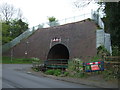
Residents of B90 2LY have access to a range of amenities within practical reach. Retail options include Sainsburys Solihull Haslucks, Co-op Haslucks, and Asda Solihull New, providing everyday shopping convenience. The area’s transport links also grant easy access to larger retail hubs. For leisure, the nearby Shirley Golf Club occupies a former racecourse, and historical sites such as St James’ Church (1832) and the Shirley Institute (founded 1901) add cultural depth. The proximity to Stratford Road and the M42 motorway ensures quick travel to Birmingham or Solihull. The urban residential character of the area means daily life is balanced between convenience and a sense of community, with amenities catering to both practical needs and historical interests.
Amenities
Schools
| Rank | School | Type | Entry gender | Ages |
|---|
Explore more schools in this area
Go to Schools tabDemographics
The population of B90 2LY is predominantly adults aged 30–64, with a median age of 47. This suggests a community of middle-aged and older residents, many of whom may be in their peak earning years or retired. Home ownership is high at 82%, with the majority of properties being houses rather than flats, indicating a preference for family-friendly or long-term living. The predominant ethnic group is White, though no specific data on minority representation is provided. The area’s character is described as less prosperous than some neighbouring suburbs but without the extremes of deprivation seen in Shirley East. This balance implies a stable quality of life with access to essential services, though it may lack the amenities of more affluent areas. The high home ownership rate also suggests a degree of economic security for residents.
Household Size
Accommodation Type
Tenure
Ethnic Group
Religion
Household Composition
Age
Household Deprivation
NS-SEC
Explore more demographic insights in this area
Go to Demographics tabPlanning
Planning Constraints
- Flood RiskPremium
- Ramsar Wetland SitesPremium
- Area of Outstanding Natural BeautyPremium
- Protected Nature ReservePremium
- Protected WoodlandPremium