Area Overview for B90 2LU
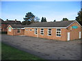
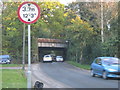
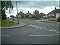
Photos of B90 2LU


Area Information
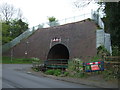
Living in B90 2LU means being part of a small, tightly knit residential cluster in the heart of Shirley, a historically rooted suburb of Solihull. With a population of 1,569, this area is defined by its urban character, nestled approximately 3 miles southeast of Solihull town centre along Stratford Road. Its origins trace back to a farming settlement, later evolving into a residential suburb with post-war housing developments like the Cranmore estate. The area’s proximity to the M42 motorway and Stratford Road ensures easy access to Birmingham and Stratford-upon-Avon, while nearby railway stations such as Shirley and Yardley Wood provide links to the broader West Midlands. Daily life here balances suburban tranquillity with urban convenience, offering a mix of historical sites like St James’ Church and modern amenities. The low crime risk and absence of environmental constraints make it a practical choice for those seeking stability without sacrificing accessibility. For buyers, B90 2LU represents a compact, established community with clear connections to regional infrastructure.
- Area Type
- Postcode
- Area Size
- Not available
- Population
- 1569
- Population Density
- 4395 people/km²
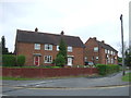
The property market in B90 2LU is dominated by owner-occupied homes, with 82% of properties owned by residents rather than rented. This high home ownership rate indicates a stable, long-term community with limited rental availability. The accommodation type is primarily houses, which contrasts with areas dominated by flats or apartments. This suggests a suburban, family-oriented environment where larger properties are more common. Buyers in B90 2LU should expect a market focused on established homes rather than new developments or investment properties. The small area’s compact size means property choices are limited to the immediate vicinity, but proximity to Solihull and Birmingham offers broader opportunities for those seeking larger or alternative housing. The predominance of houses also implies lower density, contributing to a quieter, more private living experience compared to urban centres.
House Prices in B90 2LU
No properties found in this postcode.
Energy Efficiency in B90 2LU
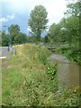
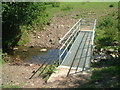
Residents of B90 2LU have access to a range of nearby amenities, including five retail outlets such as Sainsburys Solihull Haslucks, Co-op Haslucks, and Asda Solihull New, ensuring everyday shopping needs are met. The area’s rail network includes Shirley, Whitlocks End, and Yardley Wood stations, while metro stops like Grand Central New Street and Corporation Street provide links to Birmingham’s central districts. Though parks and green spaces are not explicitly named, the absence of protected natural areas suggests open spaces may be limited. The historical character of Shirley, with sites like St James’ Church and the Shirley Institute, adds cultural depth to daily life. The mix of retail, transport, and historical sites creates a lifestyle that balances convenience with a sense of place, suitable for those valuing accessibility without sacrificing a connection to local heritage.
Amenities
Schools
| Rank | School | Type | Entry gender | Ages |
|---|
Explore more schools in this area
Go to Schools tabDemographics
The community in B90 2LU is predominantly composed of adults aged 30–64, with a median age of 47. This suggests a mature, stable population, likely comprising working professionals and families. Home ownership is high at 82%, indicating a strong preference for long-term residency over rental properties. The area is characterised by houses rather than flats, reflecting a traditional suburban layout. The predominant ethnic group is White, though no specific diversity metrics are provided. The absence of deprivation data means the area likely avoids the extremes seen in parts of Shirley East, such as Solihull Lodge. This demographic profile implies a community focused on established living, with fewer transient residents. The age range suggests a balance between active professionals and those nearing retirement, shaping local amenities and services to meet their needs.
Household Size
Accommodation Type
Tenure
Ethnic Group
Religion
Household Composition
Age
Household Deprivation
NS-SEC
Explore more demographic insights in this area
Go to Demographics tabPlanning
Planning Constraints
- Flood RiskPremium
- Ramsar Wetland SitesPremium
- Area of Outstanding Natural BeautyPremium
- Protected Nature ReservePremium
- Protected WoodlandPremium