Area Overview for B9 5JG
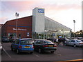
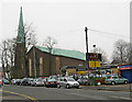
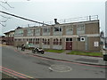
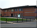
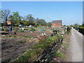
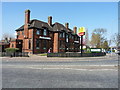
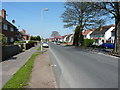
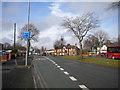
Photos of B9 5JG

Area Information
B9 5JG is a compact residential postcode in Birmingham, England, covering 8.2 hectares and home to 2,110 residents. Its high population density of 25,720 people per square kilometre reflects a tightly knit community, though the area remains small enough to feel intimate. Situated near Heartlands Hospital, the postcode is part of the Bordesley Green East ward, a district known for its healthcare infrastructure. Daily life here is shaped by proximity to major transport routes, including the A45 Coventry Road and nearby motorway junctions, making commuting efficient. The area’s character is defined by its mix of residential clusters and essential services, with the hospital serving as a central landmark. While the population is young, with a median age of 22, the majority of residents fall within the 30-64 age range, suggesting a balance between established families and working-age adults. Living in B9 5JG means navigating a high-density urban environment with strong connectivity to regional hubs, though the small area size means every resident is within close reach of key amenities.
- Area Type
- Postcode
- Area Size
- 8.2 hectares
- Population
- 2110
- Population Density
- 4316 people/km²
The property market in B9 5JG is characterised by a high proportion of owner-occupied homes, with 58% of residents owning their properties. This suggests a stable market where long-term residency is common. The accommodation type is predominantly houses, which is notable for a postcode of this size, indicating a mix of semi-detached or terraced housing. This contrasts with larger urban areas where flats dominate, and may appeal to buyers seeking more space in a compact setting. However, the small area size means the housing stock is limited, and buyers should consider the immediate surroundings for more options. The high population density also implies that properties may be in close proximity to one another, which could be a consideration for those prioritising privacy. For those looking to invest, the area’s proximity to transport links and essential services may offset its limited housing stock.
House Prices in B9 5JG
Showing 41 properties
| Address | Type | Beds | Baths | Last Sale Price | Last Sale Date | |
|---|---|---|---|---|---|---|
| 88 Newbridge Road, Birmingham, B9 5JG | Retail | 3 | 1 | £120,000 | Oct 2022 | |
| 48 Newbridge Road, Birmingham, B9 5JG | Maisonette | 3 | 1 | £160,000 | Sep 2022 | |
| 52 Newbridge Road, Birmingham, B9 5JG | Maisonette | 3 | 1 | £145,000 | Apr 2022 | |
| 54 Newbridge Road, Birmingham, B9 5JG | Flat | - | - | £141,500 | Oct 2021 | |
| 80 Newbridge Road, Birmingham, B9 5JG | Terraced | 3 | 1 | £166,000 | Jan 2021 | |
| 84 Newbridge Road, Birmingham, B9 5JG | Flat | 3 | 1 | £119,000 | Jan 2019 | |
| 82 Newbridge Road, Birmingham, B9 5JG | Terraced | 3 | 1 | £171,000 | Apr 2018 | |
| 12 Newbridge Road, Birmingham, B9 5JG | Semi-detached | 3 | 3 | £150,000 | Mar 2017 | |
| 18 Newbridge Road, Birmingham, B9 5JG | Semi-detached | 3 | 1 | £200,000 | Dec 2015 | |
| 38 Newbridge Road, Birmingham, B9 5JG | Terraced | 3 | - | £176,000 | Jun 2014 |
Energy Efficiency in B9 5JG
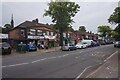
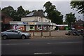
Residents of B9 5JG have access to a range of nearby amenities, including retail outlets such as M&S Birmingham, Aldi Alum, and Iceland Heybarnes. These stores offer convenience for daily shopping needs, though the selection is limited compared to larger retail centres. The area’s proximity to Heartlands Hospital and its surrounding infrastructure means healthcare services are readily available. For leisure and dining, the postcode’s location near Birmingham’s central districts likely provides access to a wider variety of restaurants and entertainment venues, though specific details are not listed in the data. The presence of multiple railway and metro stations also facilitates trips to nearby shopping centres or cultural attractions. While the immediate area is compact, its integration with Birmingham’s transport network allows residents to enjoy the city’s broader amenities without significant travel time.
Amenities
Schools
The nearest school to B9 5JG is Eden Girls’ Leadership Academy in Birmingham, an academy with an outstanding Ofsted rating. This school serves the local community and is likely a key consideration for families in the area. The presence of a high-performing academy suggests that educational standards are strong, though the data does not specify other schools in the immediate vicinity. The single listed school indicates that parents may need to look beyond the postcode for additional options, particularly for younger children or those requiring specialist provisions. The academy’s outstanding rating, however, provides a clear advantage for families prioritising quality education. Given the area’s proximity to major transport routes, commuting to other schools in Birmingham is feasible, though the lack of nearby schools means the community relies heavily on this one institution.
| Rank | School | Type | Entry gender | Ages |
|---|
Explore more schools in this area
Go to Schools tabDemographics
The community in B9 5JG is predominantly composed of adults aged 30-64, making up the most common age range. With a median age of 22, the area shows a younger demographic skew, possibly influenced by nearby educational or employment opportunities. Home ownership is strong, with 58% of residents owning their homes, indicating a stable housing market. The predominant accommodation type is houses, which is unusual for a high-density urban postcode, suggesting a mix of semi-detached or terraced properties. The predominant ethnic group is Asian, reflecting broader demographic trends in Birmingham. While specific deprivation data is not provided, the high population density and proximity to essential services like Heartlands Hospital imply a community with access to healthcare and public infrastructure. However, the lack of detailed socioeconomic data means the area’s quality of life cannot be fully assessed without further context.
Household Size
Accommodation Type
Tenure
Ethnic Group
Religion
Household Composition
Age
Household Deprivation
NS-SEC
Explore more demographic insights in this area
Go to Demographics tabPlanning
Planning Constraints
- Flood RiskPremium
- Ramsar Wetland SitesPremium
- Area of Outstanding Natural BeautyPremium
- Protected Nature ReservePremium
- Protected WoodlandPremium