Area Overview for B9 5JE
Photos of B9 5JE


Area Information
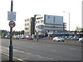
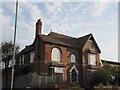
Living in B9 5JE means inhabiting a tightly knit residential cluster in Birmingham’s West Midlands, where 2,110 people reside across 5.4 hectares. This small postcode area is defined by its compact size and proximity to Heartlands Hospital, a major healthcare hub managed by University Hospitals Birmingham NHS Foundation Trust. The area’s population density of 38,989 people per square kilometre reflects a densely populated yet focused community. Daily life here is shaped by its location near key transport routes, including the A45 Coventry Road and nearby motorway junctions, making commuting efficient. The area’s character is anchored by its healthcare infrastructure and practical connectivity, though its small size means residents often rely on nearby amenities in surrounding wards. Despite its density, B9 5JE offers a mix of residential stability, with 58% of homes owner-occupied, and a community skewed toward adults aged 30–64. For those seeking a compact, functional living space with essential services nearby, this area provides a focused, practical alternative to larger urban zones.
- Area Type
- Postcode
- Area Size
- 5.4 hectares
- Population
- 2110
- Population Density
- 4316 people/km²
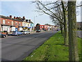
The property market in B9 5JE is characterised by a 58% home ownership rate, with houses forming the primary accommodation type. This suggests a mix of single-family homes and smaller residences, though the area’s compact size limits housing diversity. As a small postcode cluster, the market is unlikely to offer a wide range of property types, making it a niche option for buyers seeking owner-occupied homes. The dominance of houses over flats or apartments may appeal to those prioritising space, though the area’s density means proximity to amenities is key. For buyers, the challenge lies in navigating the limited stock, with potential value tied to the area’s connectivity to transport and healthcare. The nearby rail and metro links, along with proximity to motorways, could offset the area’s small footprint for those prioritising accessibility over expansive living space.
House Prices in B9 5JE
Showing 33 properties
| Address | Type | Beds | Baths | Last Sale Price | Last Sale Date | |
|---|---|---|---|---|---|---|
| 69 Newbridge Road, Birmingham, B9 5JE | Semi-detached | 3 | 1 | £300,000 | Sep 2022 | |
| 75 Newbridge Road, Birmingham, B9 5JE | Semi-detached | 3 | - | £280,000 | Feb 2022 | |
| 33 Newbridge Road, Birmingham, B9 5JE | house | - | - | £283,000 | Aug 2021 | |
| 23 Newbridge Road, Birmingham, B9 5JE | house | 3 | 1 | £158,000 | Feb 2020 | |
| 45 Newbridge Road, Birmingham, B9 5JE | Semi-detached | 5 | 2 | £299,000 | Jan 2020 | |
| 61 Newbridge Road, Birmingham, B9 5JE | Semi-detached | 3 | 1 | £230,000 | Jan 2019 | |
| 67 Newbridge Road, Birmingham, B9 5JE | house | 4 | 2 | £263,000 | Jan 2019 | |
| 43 Newbridge Road, Birmingham, B9 5JE | Semi-detached | 3 | 2 | £16,800 | Dec 2018 | |
| 47 Newbridge Road, Birmingham, B9 5JE | Semi-detached | 3 | 1 | £225,000 | Mar 2018 | |
| 57 Newbridge Road, Birmingham, B9 5JE | house | - | - | £165,000 | Nov 2012 |
Energy Efficiency in B9 5JE
Residents of B9 5JE have access to a range of nearby amenities, including five retail outlets such as M&S Birmingham, Aldi Alum, and Lidl Yardley, offering everyday shopping convenience. The area’s proximity to rail and metro stations ensures easy access to Birmingham’s cultural and commercial hubs, while the presence of Heartlands Hospital adds to the local infrastructure. Though the area itself is small, its connectivity to surrounding wards means residents can enjoy a broader array of leisure and dining options beyond the immediate postcode. The mix of retail, transport, and healthcare facilities creates a functional lifestyle, where practicality and accessibility take precedence. For those valuing convenience over expansive leisure spaces, B9 5JE provides a compact yet well-served environment.
Amenities
Schools
The nearest school to B9 5JE is Eden Girls’ Leadership Academy in Birmingham, an academy with an outstanding Ofsted rating. This institution offers a high standard of education, which is critical for families prioritising academic excellence. The presence of a single outstanding school in the immediate vicinity suggests that the area may cater to families seeking quality education, though the lack of additional schools could mean reliance on nearby wards for broader options. The academy’s status as an academy implies autonomy in curriculum and governance, potentially offering specialised programmes. For parents, the school’s rating provides reassurance, though the limited number of educational institutions in the area may require consideration of commuting distances for other schooling needs.
| Rank | School | Type | Entry gender | Ages |
|---|
Explore more schools in this area
Go to Schools tabDemographics
The community in B9 5JE is predominantly composed of adults aged 30–64, with a median age of 22, suggesting a mix of younger and middle-aged residents. Home ownership here stands at 58%, indicating a stable residential base, though the area’s small size means limited housing diversity. The accommodation type is primarily houses, which is unusual for a densely populated postcode, hinting at a blend of single-family homes and smaller dwellings. The predominant ethnic group is Asian, reflecting broader demographic trends in Birmingham. While no specific deprivation data is provided, the high population density and focus on owner-occupied housing suggest a community that prioritises stability and proximity to services. The presence of Heartlands Hospital also implies a workforce tied to healthcare, shaping the area’s economic and social fabric.
Household Size
Accommodation Type
Tenure
Ethnic Group
Religion
Household Composition
Age
Household Deprivation
NS-SEC
Explore more demographic insights in this area
Go to Demographics tabPlanning
Planning Constraints
- Flood RiskPremium
- Ramsar Wetland SitesPremium
- Area of Outstanding Natural BeautyPremium
- Protected Nature ReservePremium
- Protected WoodlandPremium