Area Overview for B80 7QP
Photos of B80 7QP
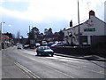
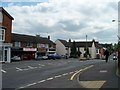
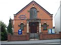
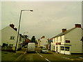
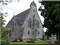
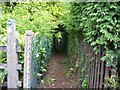
55 photos from this area
Area Information
Key information about the B80 7QP including its size, population, and administrative classification.
- Area Type
- Postcode
- Area Size
- 1.3 hectares
- Population
- 1528
- Population Density
- 1487 people/km²
House Prices in B80 7QP
25
Properties
£180,632
Average Sold Price
£58,000
Lowest Price
£291,500
Highest Price
Showing 25 properties
| Address | Type | Beds | Baths | Last Sale Price | Last Sale Date | |
|---|---|---|---|---|---|---|
| 47 Toms Town Lane, Studley, B80 7QP | Semi-detached | 3 | 2 | £127,500 | Mar 2025 | |
| 61 Toms Town Lane, Studley, B80 7QP | Semi-detached | 3 | 1 | £291,500 | Jun 2022 | |
| 72 Toms Town Lane, Studley, B80 7QP | house | - | - | £255,000 | Sep 2021 | |
| 70 Toms Town Lane, Studley, B80 7QP | house | - | - | £255,000 | Sep 2021 | |
| 54 Toms Town Lane, Studley, B80 7QP | Terraced | 3 | 1 | £265,000 | Nov 2018 | |
| 60 Toms Town Lane, Studley, B80 7QP | house | 3 | 1 | £135,000 | Jun 2011 | |
| 68 Toms Town Lane, Studley, B80 7QP | house | - | - | £125,000 | Nov 2007 | |
| 59 Toms Town Lane, Studley, B80 7QP | Semi-detached | - | - | £168,000 | Jun 2004 | |
| 49 Toms Town Lane, Studley, B80 7QP | Semi-detached | - | - | £174,950 | May 2004 | |
| 57 Toms Town Lane, Studley, B80 7QP | Semi-detached | - | - | £132,000 | Dec 2002 |
Page 1 of 3
Energy Efficiency in B80 7QP
Amenities
Schools
| Rank | School | Type | Entry gender | Ages |
|---|
Explore more schools in this area
Go to Schools tabDemographics
Household Size
Two person
most common
Accommodation Type
Houses
most common
Tenure
66
majority
Ethnic Group
White
most common
Religion
N/A
most common
Household Composition
N/A
most common
Age
47
median
Adults (30-64 years)
most common
Household Deprivation
N/A
with no deprivation
NS-SEC
31
in Lower managerial occupations
Explore more demographic insights in this area
Go to Demographics tabPlanning
Planning Constraints
- Flood RiskPremium
- Ramsar Wetland SitesPremium
- Area of Outstanding Natural BeautyPremium
- Protected Nature ReservePremium
- Protected WoodlandPremium