Area Overview for B80 7NA
Photos of B80 7NA

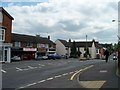
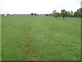


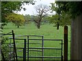

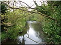
55 photos from this area
Area Information
Key information about the B80 7NA including its size, population, and administrative classification.
- Area Type
- Postcode
- Area Size
- 6470 m²
- Population
- 1655
- Population Density
- 249 people/km²
House Prices in B80 7NA
18
Properties
£183,960
Average Sold Price
£59,000
Lowest Price
£395,000
Highest Price
Showing 18 properties
| Address | Type | Beds | Baths | Last Sale Price | Last Sale Date | |
|---|---|---|---|---|---|---|
| 6 Manor Road, Studley, B80 7NA | Terraced | 4 | 2 | £375,000 | Aug 2022 | |
| 1 Manor Road, Studley, B80 7NA | house | - | - | £395,000 | Mar 2021 | |
| 11 Manor Road, Studley, B80 7NA | Semi-detached | 3 | 1 | £263,000 | Nov 2019 | |
| 7 Manor Road, Studley, B80 7NA | Semi-detached | 3 | 3 | £290,000 | Mar 2018 | |
| 2 Manor Road, Studley, B80 7NA | house | - | - | £239,950 | Oct 2015 | |
| 3 Manor Road, Studley, B80 7NA | Semi-detached | 2 | 1 | £137,000 | May 2013 | |
| 18 Manor Road, Studley, B80 7NA | Flat | - | - | £110,000 | Jun 2008 | |
| 9 Manor Road, Studley, B80 7NA | Semi-detached | - | - | £201,000 | Dec 2006 | |
| 22 Manor Road, Studley, B80 7NA | Flat | - | - | £105,000 | Dec 2004 | |
| 10 Manor Road, Studley, B80 7NA | Terraced | - | - | £133,500 | Apr 2003 |
Page 1 of 2
Energy Efficiency in B80 7NA
Amenities
Schools
| Rank | School | Type | Entry gender | Ages |
|---|
Explore more schools in this area
Go to Schools tabDemographics
Household Size
Two person
most common
Accommodation Type
Houses
most common
Tenure
75
majority
Ethnic Group
White
most common
Religion
N/A
most common
Household Composition
N/A
most common
Age
47
median
Adults (30-64 years)
most common
Household Deprivation
N/A
with no deprivation
NS-SEC
38
in Lower managerial occupations
Explore more demographic insights in this area
Go to Demographics tabPlanning
Planning Constraints
- Flood RiskPremium
- Ramsar Wetland SitesPremium
- Area of Outstanding Natural BeautyPremium
- Protected Nature ReservePremium
- Protected WoodlandPremium