Area Overview for B8 3PP
Photos of B8 3PP
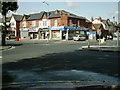
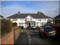
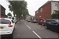
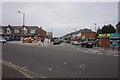
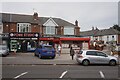
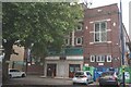
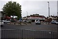
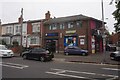
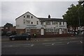
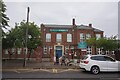
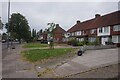
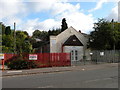
28 photos from this area
Area Information
Key information about the B8 3PP including its size, population, and administrative classification.
- Area Type
- Postcode
- Area Size
- 1.4 hectares
- Population
- 2025
- Population Density
- 9859 people/km²
House Prices in B8 3PP
27
Properties
£76,333
Average Sold Price
£62,000
Lowest Price
£100,000
Highest Price
Showing 27 properties
| Address | Type | Beds | Baths | Last Sale Price | Last Sale Date | |
|---|---|---|---|---|---|---|
| 720A Alum Rock Road, Birmingham, B8 3PP | Retail | - | 2 | £100,000 | Feb 2012 | |
| Flat At, 764 Alum Rock Road, Birmingham, B8 3PP | Flat | - | - | £62,000 | Oct 2008 | |
| 754A Alum Rock Road, Birmingham, B8 3PP | house | - | - | £67,000 | Jul 2004 | |
| Flat, 748-752 Alum Rock Road, Birmingham, B8 3PP | Terraced | 5 | 2 | - | - | |
| 710A Alum Rock Road, Birmingham, B8 3PP | undefined | - | - | - | - | |
| 716 Alum Rock Road, Birmingham, B8 3PP | undefined | - | - | - | - | |
| Flat Above, 758 Alum Rock Road, Birmingham, B8 3PP | Flat | - | - | - | - | |
| Flat, 762 Alum Rock Road, Birmingham, B8 3PP | Flat | - | - | - | - | |
| 746A Alum Rock Road, Birmingham, B8 3PP | Flat | - | - | - | - | |
| Flat, 760 Alum Rock Road, Birmingham, B8 3PP | Flat | - | - | - | - |
Page 1 of 3
Energy Efficiency in B8 3PP
Amenities
Schools
| Rank | School | Type | Entry gender | Ages |
|---|
Explore more schools in this area
Go to Schools tabDemographics
Household Size
Family (3-5 people)
most common
Accommodation Type
Houses
most common
Tenure
54
majority
Ethnic Group
asian_total
most common
Religion
N/A
most common
Household Composition
N/A
most common
Age
22
median
Adults (30-64 years)
most common
Household Deprivation
N/A
with no deprivation
NS-SEC
11
in Lower managerial occupations
Explore more demographic insights in this area
Go to Demographics tabPlanning
Planning Constraints
- Flood RiskPremium
- Ramsar Wetland SitesPremium
- Area of Outstanding Natural BeautyPremium
- Protected Nature ReservePremium
- Protected WoodlandPremium