Area Overview for B8 3BB
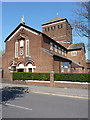
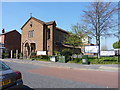
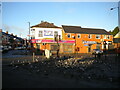
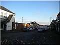
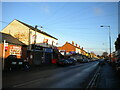
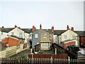
Photos of B8 3BB
Area Information
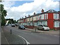
B8 3BB is a small residential cluster covering 5,306 square metres with a population of 1,528 people. This postcode sits within Alum Rock, an inner-city suburb of Birmingham located approximately 3.2 km from the city centre. The area functions as a dense, tightly packed neighbourhood distinct for its high residential concentration. Historical records indicate the name derives from alum rock used in leather tanning dating back to 1718. Prior to the 1974 boundary changes, the area was part of northwestern Warwickshire, later becoming the Washwood Heath ward before forming the current Alum Rock ward in 2018. Daily life here revolves around a high population density of 287,972 people per square kilometre. This intensity creates a vibrant urban environment characterised by significant diversity and a young demographic profile. Residents live close to the wider Saltley area, accessed via Alum Rock Road which connects to Stechford and Ward End. The neighbourhood reflects the broader character of Birmingham's most populous ward, offering a straightforward urban living experience without the sprawl of suburban districts. You will find a community deeply rooted in the city's fabric, situated between the historic Saltley Gate and the industrial legacy of the railway bridge.
- Area Type
- Postcode
- Area Size
- 5306 m²
- Population
- 1528
- Population Density
- 6883 people/km²
The property market in B8 3BB is dominated by rental housing, evident from the fact that only 36% of residents own their homes. The accommodation type is listed as houses, which distinguishes this cluster from many inner-city Victorian conversions or flatted developments. This suggests a housing stock that relies on standalone or detached properties rather than high-rise blocks. Potential buyers looking at homes in B8 3BB face a market where second-hand ownership rates are lower than the borough average. With such a low home ownership percentage, the supply of shared ownership or buy-to-let properties may be significant alongside regular sales. The small size of the postcode area, covering just 5,306 square metres, limits the total inventory available. This concentration means competition for any available house could be intense. The mix of a young median age and a history of high deprivation often correlates with specific price points relative to other Birmingham wards. You should approach the market here with an understanding that affordability remains a primary driver for most residents, and the stock likely reflects long-term occupation patterns common in densely populated urban wards.
House Prices in B8 3BB
Showing 1 properties
| Address | Type | Beds | Baths | Last Sale Price | Last Sale Date | |
|---|---|---|---|---|---|---|
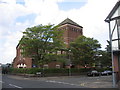
| Presbytery, Parkfield Road, Birmingham, B8 3BB | Detached | - | - | - | - |
Energy Efficiency in B8 3BB
Residents of B8 3BB enjoy immediate access to essential retail and leisure amenities within walking distance. The local retail sector is robust, featuring major supermarkets such as Lidl Bordesley, Asda Bordersley, and Morrisons Bordesley. These venues provide daily necessities without the need to travel far into the city centre. Alongside shopping, the area is served by five metres of direct metro access points at notable locations including Bull Street, Corporation Street, and St Chads. Rail travel is equally convenient for those wishing to travel further than the city centre. Five railway stations, including Adderley Park, Duddeston, and Bordesley, are situated nearby. This network allows for quick trips to the airport or regional towns. The lifestyle here is defined by convenience and urban proximity. You do not need to leave the neighbourhood to find food, shopping, or transport links. The density of services supports a self-contained daily routine. Whether you are running errands or commuting for work, the infrastructure surrounding B8 3BB is designed to keep you connected to the city's core activities.
Amenities
Schools
Families living near B8 3BB have access to several educational institutions with varying structures and ratings. Parkfield Community School appears in the data multiple times; it operates as both a primary school and an academy with an outstanding Ofsted rating. This dual designation highlights the school's strong performance and integrated governance structure within the local education landscape. The Rosary Catholic Primary School offers religious education within the primary sector and holds a good Ofsted rating. Its classification as a faith school provides an alternative option for parents seeking a specific educational philosophy. Additionally, Sanctuary Education stands out as an independent option within the immediate vicinity. The presence of these different school types means you can choose between maintained academies, faith-based primary settings, or private education. With an outstanding rating for its academy status and a good rating for the Catholic option, the local educational provisions show a commitment to high standards across different sectors.
| Rank | School | Type | Entry gender | Ages |
|---|
Explore more schools in this area
Go to Schools tabDemographics
The community in B8 3BB is defined by a very young median age of 22 years. While adult home ownership accounts for the most common age range between 30 and 64 years, the area's median age remains the lowest comparator in the dataset. Currently, 36% of residents own their homes, meaning the majority live in rental properties. The accommodation stock consists primarily of houses, providing a traditional housing stock despite the high density. Ethnically, the predominant group is Asian. The area features a significantly younger age profile compared to the national average, resulting in a higher proportion of residents in the 0 to 14 and 30 to 64 age bands. Deprivation levels reflect the borough average, with high shares of working-age residents holding no qualifications. This pattern is consistent with the broader Alum Rock ward, which records the highest share of working-age individuals without qualifications in Birmingham. When considering living in B8 3BB, you should expect a community where younger households and renters form the backbone of social life. The demographic mix suggests an area in flux, driven by recent arrivals and families seeking affordable space in the city.
Household Size
Accommodation Type
Tenure
Ethnic Group
Religion
Household Composition
Age
Household Deprivation
NS-SEC
Explore more demographic insights in this area
Go to Demographics tabPlanning
Planning Constraints
- Flood RiskPremium
- Ramsar Wetland SitesPremium
- Area of Outstanding Natural BeautyPremium
- Protected Nature ReservePremium
- Protected WoodlandPremium