Area Overview for B8 2RP
Photos of B8 2RP
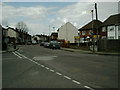

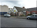
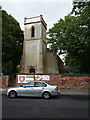
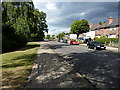
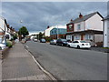
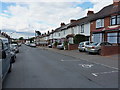

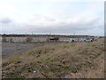
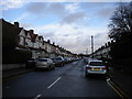
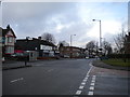
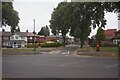
26 photos from this area
Area Information
Key information about the B8 2RP including its size, population, and administrative classification.
- Area Type
- Postcode
- Area Size
- 7028 m²
- Population
- 2211
- Population Density
- 6424 people/km²
House Prices in B8 2RP
26
Properties
£115,770
Average Sold Price
£40,000
Lowest Price
£215,000
Highest Price
Showing 26 properties
| Address | Type | Beds | Baths | Last Sale Price | Last Sale Date | |
|---|---|---|---|---|---|---|
| 42 Old Bromford Lane, Birmingham, B8 2RP | Bungalow | 2 | 1 | £170,000 | Feb 2025 | |
| 86 Old Bromford Lane, Birmingham, B8 2RP | Semi-detached | 3 | 2 | £215,000 | Aug 2022 | |
| 52 Old Bromford Lane, Birmingham, B8 2RP | Semi-detached | 3 | 1 | £200,000 | Apr 2020 | |
| 40 Old Bromford Lane, Birmingham, B8 2RP | Bungalow | 2 | 1 | £171,000 | Jan 2020 | |
| 68 Old Bromford Lane, Birmingham, B8 2RP | Semi-detached | 3 | 1 | £160,000 | Apr 2019 | |
| 82 Old Bromford Lane, Birmingham, B8 2RP | Semi-detached | 3 | 1 | £107,000 | Dec 2016 | |
| 46 Old Bromford Lane, Birmingham, B8 2RP | Semi-detached | 3 | 1 | £130,000 | Jan 2016 | |
| 74 Old Bromford Lane, Birmingham, B8 2RP | house | - | - | £95,000 | Nov 2014 | |
| 66 Old Bromford Lane, Birmingham, B8 2RP | house | 3 | - | £105,000 | May 2010 | |
| 50 Old Bromford Lane, Birmingham, B8 2RP | Semi-detached | - | - | £144,000 | Feb 2008 |
Page 1 of 3
Energy Efficiency in B8 2RP
Amenities
Schools
| Rank | School | Type | Entry gender | Ages |
|---|
Explore more schools in this area
Go to Schools tabDemographics
Household Size
Family (3-5 people)
most common
Accommodation Type
Houses
most common
Tenure
68
majority
Ethnic Group
asian_total
most common
Religion
N/A
most common
Household Composition
N/A
most common
Age
47
median
Adults (30-64 years)
most common
Household Deprivation
N/A
with no deprivation
NS-SEC
19
in Lower managerial occupations
Explore more demographic insights in this area
Go to Demographics tabPlanning
Planning Constraints
- Flood RiskPremium
- Ramsar Wetland SitesPremium
- Area of Outstanding Natural BeautyPremium
- Protected Nature ReservePremium
- Protected WoodlandPremium