Area Overview for B8 2RL
Photos of B8 2RL


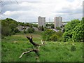
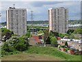
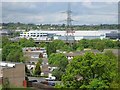
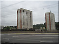
26 photos from this area
Area Information
Key information about the B8 2RL including its size, population, and administrative classification.
- Area Type
- Postcode
- Area Size
- 9318 m²
- Population
- 2211
- Population Density
- 6424 people/km²
House Prices in B8 2RL
30
Properties
£88,037
Average Sold Price
£4,000
Lowest Price
£163,000
Highest Price
Showing 30 properties
| Address | Type | Beds | Baths | Last Sale Price | Last Sale Date | |
|---|---|---|---|---|---|---|
| 5 Gilpin Close, Birmingham, B8 2RL | Flat | 1 | 1 | £105,000 | Nov 2022 | |
| 49 Gilpin Close, Birmingham, B8 2RL | house | - | - | £163,000 | Jul 2021 | |
| 31 Gilpin Close, Birmingham, B8 2RL | Flat | - | - | £4,000 | May 2019 | |
| 19 Gilpin Close, Birmingham, B8 2RL | Maisonette | 2 | 1 | £95,000 | Mar 2017 | |
| 27 Gilpin Close, Birmingham, B8 2RL | Terraced | 3 | 1 | £125,600 | Nov 2016 | |
| 23 Gilpin Close, Birmingham, B8 2RL | Semi-detached | 3 | 1 | £114,000 | Feb 2016 | |
| 25 Gilpin Close, Birmingham, B8 2RL | Terraced | 3 | - | £116,000 | Jun 2015 | |
| 37 Gilpin Close, Birmingham, B8 2RL | Maisonette | 2 | 1 | £63,000 | Jul 2013 | |
| 29 Gilpin Close, Birmingham, B8 2RL | house | - | - | £110,000 | Dec 2012 | |
| 7 Gilpin Close, Birmingham, B8 2RL | Flat | - | - | £54,000 | May 2012 |
Page 1 of 3
Energy Efficiency in B8 2RL
Amenities
Schools
| Rank | School | Type | Entry gender | Ages |
|---|
Explore more schools in this area
Go to Schools tabDemographics
Household Size
Family (3-5 people)
most common
Accommodation Type
Houses
most common
Tenure
68
majority
Ethnic Group
asian_total
most common
Religion
N/A
most common
Household Composition
N/A
most common
Age
47
median
Adults (30-64 years)
most common
Household Deprivation
N/A
with no deprivation
NS-SEC
19
in Lower managerial occupations
Explore more demographic insights in this area
Go to Demographics tabPlanning
Planning Constraints
- Flood RiskPremium
- Ramsar Wetland SitesPremium
- Area of Outstanding Natural BeautyPremium
- Protected Nature ReservePremium
- Protected WoodlandPremium