Area Overview for B77 3NB
Photos of B77 3NB
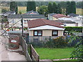

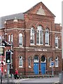

100 photos from this area
Area Information
Key information about the B77 3NB including its size, population, and administrative classification.
- Area Type
- Postcode
- Area Size
- 1.5 hectares
- Population
- 1623
- Population Density
- 4408 people/km²
House Prices in B77 3NB
34
Properties
£155,614
Average Sold Price
£59,000
Lowest Price
£235,000
Highest Price
Showing 34 properties
| Address | Type | Beds | Baths | Last Sale Price | Last Sale Date | |
|---|---|---|---|---|---|---|
| 10 Riverfield Grove, Tamworth, B77 3NB | Semi-detached | 3 | 1 | £212,500 | Sep 2025 | |
| 22 Riverfield Grove, Tamworth, B77 3NB | Semi-detached | 3 | 1 | £235,000 | Sep 2024 | |
| 15 Riverfield Grove, Tamworth, B77 3NB | Retail | 2 | 1 | £218,000 | Oct 2022 | |
| 36 Riverfield Grove, Tamworth, B77 3NB | Semi-detached | 3 | - | £230,000 | Jul 2022 | |
| 26 Riverfield Grove, Tamworth, B77 3NB | Retail | 3 | 1 | £227,500 | Feb 2022 | |
| 16 Riverfield Grove, Tamworth, B77 3NB | Semi-detached | - | - | £175,000 | Sep 2021 | |
| 6 Riverfield Grove, Tamworth, B77 3NB | Semi-detached | 3 | 1 | £174,000 | May 2021 | |
| 19 Riverfield Grove, Tamworth, B77 3NB | Semi-detached | 2 | 1 | £159,000 | Feb 2019 | |
| 28 Riverfield Grove, Tamworth, B77 3NB | Semi-detached | 3 | 1 | £166,500 | Dec 2015 | |
| 17 Riverfield Grove, Tamworth, B77 3NB | Semi-detached | 2 | 1 | £105,000 | Sep 2012 |
Page 1 of 4
Energy Efficiency in B77 3NB
Amenities
Schools
| Rank | School | Type | Entry gender | Ages |
|---|
Explore more schools in this area
Go to Schools tabDemographics
Household Size
Family (3-5 people)
most common
Accommodation Type
Houses
most common
Tenure
56
majority
Ethnic Group
White
most common
Religion
N/A
most common
Household Composition
N/A
most common
Age
47
median
Adults (30-64 years)
most common
Household Deprivation
N/A
with no deprivation
NS-SEC
21
in Lower managerial occupations
Explore more demographic insights in this area
Go to Demographics tabPlanning
Planning Constraints
- Flood RiskPremium
- Ramsar Wetland SitesPremium
- Area of Outstanding Natural BeautyPremium
- Protected Nature ReservePremium
- Protected WoodlandPremium