Area Overview for B77 3LZ
Photos of B77 3LZ
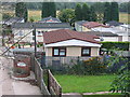


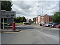

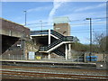

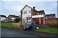
100 photos from this area
Area Information
Key information about the B77 3LZ including its size, population, and administrative classification.
- Area Type
- Postcode
- Area Size
- 6904 m²
- Population
- 1623
- Population Density
- 4408 people/km²
House Prices in B77 3LZ
20
Properties
£126,716
Average Sold Price
£40,000
Lowest Price
£215,000
Highest Price
Showing 20 properties
| Address | Type | Beds | Baths | Last Sale Price | Last Sale Date | |
|---|---|---|---|---|---|---|
| 70 Leedham Avenue, Bolehall, Tamworth, B77 3LZ | Semi-detached | 3 | 1 | £215,000 | Jul 2024 | |
| 59 Leedham Avenue, Bolehall, Tamworth, B77 3LZ | Terraced | 3 | 1 | £185,000 | Sep 2020 | |
| 57 Leedham Avenue, Bolehall, Tamworth, B77 3LZ | Terraced | 3 | - | £140,000 | Sep 2019 | |
| 72 Leedham Avenue, Bolehall, Tamworth, B77 3LZ | Semi-detached | 3 | 2 | £182,500 | Mar 2018 | |
| 47 Leedham Avenue, Bolehall, Tamworth, B77 3LZ | Terraced | 3 | 1 | £140,000 | Sep 2017 | |
| 63 Leedham Avenue, Bolehall, Tamworth, B77 3LZ | house | 3 | - | £123,000 | Mar 2012 | |
| 78 Leedham Avenue, Bolehall, Tamworth, B77 3LZ | house | - | - | £101,174 | Nov 2010 | |
| 49 Leedham Avenue, Bolehall, Tamworth, B77 3LZ | Terraced | 3 | 1 | £107,250 | Feb 2008 | |
| 55 Leedham Avenue, Bolehall, Tamworth, B77 3LZ | house | - | - | £115,000 | Mar 2006 | |
| 53 Leedham Avenue, Bolehall, Tamworth, B77 3LZ | Terraced | - | - | £44,950 | Dec 1999 |
Page 1 of 2
Energy Efficiency in B77 3LZ
Amenities
Schools
| Rank | School | Type | Entry gender | Ages |
|---|
Explore more schools in this area
Go to Schools tabDemographics
Household Size
Family (3-5 people)
most common
Accommodation Type
Houses
most common
Tenure
56
majority
Ethnic Group
White
most common
Religion
N/A
most common
Household Composition
N/A
most common
Age
47
median
Adults (30-64 years)
most common
Household Deprivation
N/A
with no deprivation
NS-SEC
21
in Lower managerial occupations
Explore more demographic insights in this area
Go to Demographics tabPlanning
Planning Constraints
- Flood RiskPremium
- Ramsar Wetland SitesPremium
- Area of Outstanding Natural BeautyPremium
- Protected Nature ReservePremium
- Protected WoodlandPremium