Area Overview for B76 2SD
Photos of B76 2SD


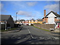

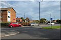
64 photos from this area
Area Information
Key information about the B76 2SD including its size, population, and administrative classification.
- Area Type
- Postcode
- Area Size
- 1.4 hectares
- Population
- 1652
- Population Density
- 1814 people/km²
House Prices in B76 2SD
20
Properties
£252,571
Average Sold Price
£74,500
Lowest Price
£550,000
Highest Price
Showing 20 properties
| Address | Type | Beds | Baths | Last Sale Price | Last Sale Date | |
|---|---|---|---|---|---|---|
| 16 Ladbroke Drive, Sutton Coldfield, B76 2SD | Semi-detached | 3 | 2 | £378,500 | Apr 2025 | |
| 14 Ladbroke Drive, Sutton Coldfield, B76 2SD | Semi-detached | 3 | 1 | £340,000 | May 2023 | |
| 11 Ladbroke Drive, Sutton Coldfield, B76 2SD | Detached | 4 | 2 | £550,000 | May 2021 | |
| 23 Ladbroke Drive, Sutton Coldfield, B76 2SD | house | 3 | 1 | £258,000 | Nov 2018 | |
| 10 Ladbroke Drive, Sutton Coldfield, B76 2SD | Semi-detached | 4 | - | £250,000 | Jul 2016 | |
| 28 Ladbroke Drive, Sutton Coldfield, B76 2SD | house | 3 | - | £202,000 | Sep 2013 | |
| 9 Ladbroke Drive, Sutton Coldfield, B76 2SD | Detached | - | - | £320,000 | Jun 2009 | |
| 19 Ladbroke Drive, Sutton Coldfield, B76 2SD | Detached | - | - | £305,000 | Dec 2007 | |
| 17 Ladbroke Drive, Sutton Coldfield, B76 2SD | Detached | - | - | £290,000 | Apr 2004 | |
| 15 Ladbroke Drive, Sutton Coldfield, B76 2SD | Detached | - | - | £249,999 | Dec 2003 |
Page 1 of 2
Energy Efficiency in B76 2SD
Amenities
Schools
| Rank | School | Type | Entry gender | Ages |
|---|
Explore more schools in this area
Go to Schools tabDemographics
Household Size
Family (3-5 people)
most common
Accommodation Type
Houses
most common
Tenure
86
majority
Ethnic Group
White
most common
Religion
N/A
most common
Household Composition
N/A
most common
Age
47
median
Adults (30-64 years)
most common
Household Deprivation
N/A
with no deprivation
NS-SEC
51
in Lower managerial occupations
Explore more demographic insights in this area
Go to Demographics tabPlanning
Planning Constraints
- Flood RiskPremium
- Ramsar Wetland SitesPremium
- Area of Outstanding Natural BeautyPremium
- Protected Nature ReservePremium
- Protected WoodlandPremium