Area Overview for B76 2PN
Photos of B76 2PN


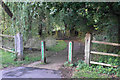
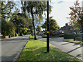
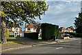
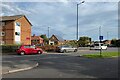
64 photos from this area
Area Information
Key information about the B76 2PN including its size, population, and administrative classification.
- Area Type
- Postcode
- Area Size
- 1.6 hectares
- Population
- 1718
- Population Density
- 2841 people/km²
House Prices in B76 2PN
29
Properties
£286,534
Average Sold Price
£65,999
Lowest Price
£450,000
Highest Price
Showing 29 properties
| Address | Type | Beds | Baths | Last Sale Price | Last Sale Date | |
|---|---|---|---|---|---|---|
| 249 Walmley Road, Sutton New Hall, Sutton Coldfield, B76 2PN | Detached | 3 | 1 | £400,000 | Nov 2025 | |
| 255 Walmley Road, Sutton New Hall, Sutton Coldfield, B76 2PN | Semi-detached | 4 | 2 | £400,000 | Feb 2025 | |
| 241 Walmley Road, Sutton New Hall, Sutton Coldfield, B76 2PN | house | - | - | £365,000 | Aug 2023 | |
| 245 Walmley Road, Sutton New Hall, Sutton Coldfield, B76 2PN | Semi-detached | 4 | 2 | £450,000 | Jun 2023 | |
| 267 Walmley Road, Sutton New Hall, Sutton Coldfield, B76 2PN | house | - | - | £427,500 | Oct 2021 | |
| 269 Walmley Road, Sutton New Hall, Sutton Coldfield, B76 2PN | house | - | - | £360,000 | Sep 2021 | |
| 259 Walmley Road, Sutton New Hall, Sutton Coldfield, B76 2PN | Semi-detached | 3 | - | £357,500 | Dec 2020 | |
| 257 Walmley Road, Sutton New Hall, Sutton Coldfield, B76 2PN | Semi-detached | 3 | 1 | £350,000 | Jul 2020 | |
| 263 Walmley Road, Sutton New Hall, Sutton Coldfield, B76 2PN | Semi-detached | 4 | 1 | £346,000 | Oct 2019 | |
| 271 Walmley Road, Sutton New Hall, Sutton Coldfield, B76 2PN | house | - | - | £345,000 | Feb 2019 |
Page 1 of 3
Energy Efficiency in B76 2PN
Amenities
Schools
| Rank | School | Type | Entry gender | Ages |
|---|
Explore more schools in this area
Go to Schools tabDemographics
Household Size
Family (3-5 people)
most common
Accommodation Type
Houses
most common
Tenure
84
majority
Ethnic Group
White
most common
Religion
N/A
most common
Household Composition
N/A
most common
Age
47
median
Adults (30-64 years)
most common
Household Deprivation
N/A
with no deprivation
NS-SEC
50
in Lower managerial occupations
Explore more demographic insights in this area
Go to Demographics tabPlanning
Planning Constraints
- Flood RiskPremium
- Ramsar Wetland SitesPremium
- Area of Outstanding Natural BeautyPremium
- Protected Nature ReservePremium
- Protected WoodlandPremium