Area Overview for B75 7JN
Photos of B75 7JN
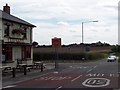
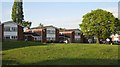

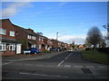
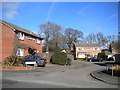


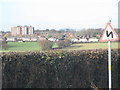

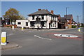
11 photos from this area
Area Information
Key information about the B75 7JN including its size, population, and administrative classification.
- Area Type
- Postcode
- Area Size
- 3682 m²
- Population
- 1651
- Population Density
- 2097 people/km²
House Prices in B75 7JN
12
Properties
£216,744
Average Sold Price
£64,000
Lowest Price
£360,000
Highest Price
Showing 12 properties
| Address | Type | Beds | Baths | Last Sale Price | Last Sale Date | |
|---|---|---|---|---|---|---|
| 257 Springfield Road, Sutton Trinity, Sutton Coldfield, B75 7JN | Terraced | 3 | 1 | £240,000 | Dec 2024 | |
| 239 Springfield Road, Sutton Trinity, Sutton Coldfield, B75 7JN | Retail | 3 | 1 | £282,000 | Sep 2022 | |
| 241 Springfield Road, Sutton Trinity, Sutton Coldfield, B75 7JN | Terraced | 3 | 1 | £277,000 | Mar 2022 | |
| 245 Springfield Road, Sutton Trinity, Sutton Coldfield, B75 7JN | house | 4 | - | £360,000 | Sep 2021 | |
| 237 Springfield Road, Sutton Trinity, Sutton Coldfield, B75 7JN | Semi-detached | 2 | 1 | £185,000 | Sep 2014 | |
| 251 Springfield Road, Sutton Trinity, Sutton Coldfield, B75 7JN | Semi-detached | 5 | 2 | £222,500 | Jan 2012 | |
| 247 Springfield Road, Sutton Trinity, Sutton Coldfield, B75 7JN | Semi-detached | 3 | 1 | £103,450 | Aug 2002 | |
| 249 Springfield Road, Sutton Trinity, Sutton Coldfield, B75 7JN | Semi-detached | - | - | £64,000 | Dec 1997 | |
| 245A Springfield Road, Sutton Trinity, Sutton Coldfield, B75 7JN | Flat | 3 | - | - | - | |
| 253 Springfield Road, Sutton Trinity, Sutton Coldfield, B75 7JN | house | - | - | - | - |
Page 1 of 2
Energy Efficiency in B75 7JN
Amenities
Schools
| Rank | School | Type | Entry gender | Ages |
|---|
Explore more schools in this area
Go to Schools tabDemographics
Household Size
Family (3-5 people)
most common
Accommodation Type
Houses
most common
Tenure
61
majority
Ethnic Group
White
most common
Religion
N/A
most common
Household Composition
N/A
most common
Age
47
median
Adults (30-64 years)
most common
Household Deprivation
N/A
with no deprivation
NS-SEC
28
in Lower managerial occupations
Explore more demographic insights in this area
Go to Demographics tabPlanning
Planning Constraints
- Flood RiskPremium
- Ramsar Wetland SitesPremium
- Area of Outstanding Natural BeautyPremium
- Protected Nature ReservePremium
- Protected WoodlandPremium