Area Overview for B75 7JJ
Photos of B75 7JJ
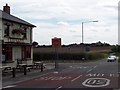
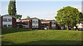
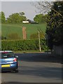
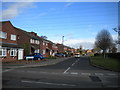
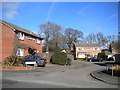


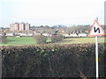

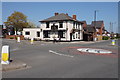
11 photos from this area
Area Information
Key information about the B75 7JJ including its size, population, and administrative classification.
- Area Type
- Postcode
- Area Size
- 14.8 hectares
- Population
- 1605
- Population Density
- 184 people/km²
House Prices in B75 7JJ
13
Properties
£200,908
Average Sold Price
£165,000
Lowest Price
£245,000
Highest Price
Showing 13 properties
| Address | Type | Beds | Baths | Last Sale Price | Last Sale Date | |
|---|---|---|---|---|---|---|
| 367 Springfield Road, Sutton Trinity, Sutton Coldfield, B75 7JJ | Semi-detached | 3 | 1 | £245,000 | Feb 2021 | |
| 361 Springfield Road, Sutton Trinity, Sutton Coldfield, B75 7JJ | Semi-detached | 3 | 1 | £245,000 | Feb 2020 | |
| 355 Springfield Road, Sutton Trinity, Sutton Coldfield, B75 7JJ | Semi-detached | 3 | 1 | £197,500 | Mar 2017 | |
| 349 Springfield Road, Sutton Trinity, Sutton Coldfield, B75 7JJ | Semi-detached | 2 | 1 | £185,000 | Sep 2016 | |
| 351 Springfield Road, Sutton Trinity, Sutton Coldfield, B75 7JJ | Semi-detached | - | - | £165,000 | Jan 2011 | |
| 357 Springfield Road, Sutton Trinity, Sutton Coldfield, B75 7JJ | Semi-detached | 3 | 1 | £167,950 | Jul 2007 | |
| 359 Springfield Road, Sutton Trinity, Sutton Coldfield, B75 7JJ | Retail | 2 | 1 | - | - | |
| 332 Springfield Road, Sutton Trinity, Sutton Coldfield, B75 7JJ | Semi-detached | 5 | - | - | - | |
| 363 Springfield Road, Sutton Trinity, Sutton Coldfield, B75 7JJ | Semi-detached | - | - | - | - | |
| 353 Springfield Road, Sutton Trinity, Sutton Coldfield, B75 7JJ | Semi-detached | - | - | - | - |
Page 1 of 2
Energy Efficiency in B75 7JJ
Amenities
Schools
| Rank | School | Type | Entry gender | Ages |
|---|
Explore more schools in this area
Go to Schools tabDemographics
Household Size
Family (3-5 people)
most common
Accommodation Type
Houses
most common
Tenure
85
majority
Ethnic Group
White
most common
Religion
N/A
most common
Household Composition
N/A
most common
Age
47
median
Adults (30-64 years)
most common
Household Deprivation
N/A
with no deprivation
NS-SEC
39
in Lower managerial occupations
Explore more demographic insights in this area
Go to Demographics tabPlanning
Planning Constraints
- Flood RiskPremium
- Ramsar Wetland SitesPremium
- Area of Outstanding Natural BeautyPremium
- Protected Nature ReservePremium
- Protected WoodlandPremium