Area Overview for B74 4BJ
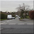
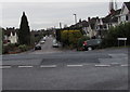
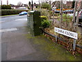
Photos of B74 4BJ
Area Information
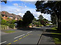
Living in B74 4BJ offers a distinct experience within the royal town of Sutton Coldfield. This specific postcode covers a small residential cluster, occupying just 1.1 hectares of land. Despite its compact footprint, it supports a population of 1,721 residents. Located in the West Midlands, England, this area sits at coordinates 52.534747, -1.833367. The name Sutton derives from Suþtun, meaning 'south town', as it lay south of Tamworth, the capital of Mercia, while Coldfield denotes a place exposed to winds or used for charcoal burning. The town became part of Birmingham in 1974. You will find yourself in an historic settlement where evidence of human presence extends back to the Bronze Age. A Royal Charter granted by King Henry VIII in 1528 created the governing society for the area. Proximity to landmarks like Sutton Park, with its medieval deer park outline, defines the setting. The High Street operates as a conservation area, preserving the character of this established community. As you navigate this neighbourhood, you are surrounded by a setting that blends ancient history with modern residential living. The B74 4BJ postcode represents a slice of life where residents enjoy close proximity to historic sites like Holy Trinity Church and Bishop Vesey's Grammar School.
- Area Type
- Postcode
- Area Size
- 1.1 hectares
- Population
- 1721
- Population Density
- 3129 people/km²
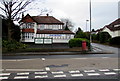
The property market in B74 4BJ is characterised by a predominantly owner-occupied stock. With home ownership rates at 75%, the area is not dominated by rental properties or investment buy-to-lets. Instead, three-quarters of the 1,721 residents live in properties they own directly. This financial commitment typically leads to well-maintained housing stock and a strong sense of place. The accommodation type in this postcode is houses. This means you will find single-family dwellings rather than high-rise blocks or landed flats. Such properties generally offer more space and garden areas, appealing to those wanting privacy and outdoor room. As an area comprising 1.1 hectares, the housing is dense with 153,930 people per square kilometre, yet the single-family nature ensures individual boundaries are respected. Buying a home here provides security given the high ownership levels. Estate agents often see fewer turnovers compared to high-rental zones. The B74 4BJ postcode reflects a stable market where residents stay long-term. If you are looking for a property, you are entering a scene defined by permanence rather than speculation. The 75% ownership statistic is a key metric for understanding the local character of homes in this specific cluster.
House Prices in B74 4BJ
Showing 13 properties
| Address | Type | Beds | Baths | Last Sale Price | Last Sale Date | |
|---|---|---|---|---|---|---|
| 394 Lichfield Road, Sutton Four Oaks, Sutton Coldfield, B74 4BJ | Bungalow | 3 | 2 | £410,000 | Jul 2020 | |
| 390 Lichfield Road, Sutton Four Oaks, Sutton Coldfield, B74 4BJ | house | - | - | £385,000 | Feb 2015 | |
| 396 Lichfield Road, Sutton Four Oaks, Sutton Coldfield, B74 4BJ | house | 6 | - | £625,000 | May 2011 | |
| 398 Lichfield Road, Sutton Four Oaks, Sutton Coldfield, B74 4BJ | house | 5 | - | £500,000 | Apr 2011 | |
| 400 Lichfield Road, Sutton Four Oaks, Sutton Coldfield, B74 4BJ | Detached | 5 | 4 | £340,000 | Dec 2009 | |
| 404 Lichfield Road, Sutton Four Oaks, Sutton Coldfield, B74 4BJ | house | - | - | £485,000 | Dec 2007 | |
| 386 Lichfield Road, Sutton Four Oaks, Sutton Coldfield, B74 4BJ | Semi-detached | - | - | £287,000 | Apr 2007 | |
| 384 Lichfield Road, Sutton Four Oaks, Sutton Coldfield, B74 4BJ | Semi-detached | - | - | £165,000 | Oct 2004 | |
| 380 Lichfield Road, Sutton Four Oaks, Sutton Coldfield, B74 4BJ | Detached | - | - | £375,000 | Feb 2004 | |
| 388 Lichfield Road, Sutton Four Oaks, Sutton Coldfield, B74 4BJ | Semi-detached | - | - | £195,000 | Nov 2000 |
Energy Efficiency in B74 4BJ
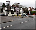
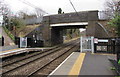
Lifestyle in B74 4BJ is centred on convenience and local retail options. Five retail outlets are within easy reach, including Aldi Belwell Lane, Cook Mere, and Lidl Sutton. These supermarkets ensure daily grocery shopping and essentials are accessible without the need to travel far. Residents also benefit from five nearby rail stations, including Butlers Lane Railway Station, Four Oaks Railway Station, and Blake Street Railway Station, which act as gateways to broader networks. The nearby amenities provide a practical support system for everyday living. You can stock up at the nearby Lidl Sutton or Aldi Belwell Lane stores before commuting. The presence of these major chains means you do not need frequent trips into larger commercial centres. The strong rail connectivity ensures that when you do need to travel, options like Blake Street Railway Station are at your disposal. For those who prefer home cooking, the local supermarkets facilitate fresh ingredient shopping. The area's compact size of 1.1 hectares means you are steps away from these facilities. This layout supports a lifestyle where errands are quick and local. The combination of fresh food access and efficient transport links creates a balanced routine for those living in the B74 4BJ postcode.
Amenities
Schools
| Rank | School | Type | Entry gender | Ages |
|---|
Explore more schools in this area
Go to Schools tabDemographics
The community in B74 4BJ is defined by a mature and established population. The median age is 47 years, with adults aged between 30 and 64 constituting the most common age range. This demographic profile suggests a neighbourhood where families and long-term residents have put down deep roots over time. The predominant ethnic group is White, reflecting a largely homogenous community structure. Home ownership stands at 75%, indicating that the vast majority of residents in this postcode live in their own properties rather than renting. This high ownership rate contrasts with many other UK areas and signals financial stability among the local population. The primary accommodation type consists of houses, fitting with the expectation of traditional family homes rather than flats or apartments. This housing stock suits those seeking stability and space. With a median age of 47, the area feels quiet and settled. You will encounter fewer young singles or transient populations compared to student-heavy districts. The 75% home ownership figure provides a clear indicator of the area's market nature. For buyers, this means the local culture revolves around settled families who cherish their homes. The concentration of adult households creates a stable environment for community engagement and local governance.
Household Size
Accommodation Type
Tenure
Ethnic Group
Religion
Household Composition
Age
Household Deprivation
NS-SEC
Explore more demographic insights in this area
Go to Demographics tabPlanning
Planning Constraints
- Flood RiskPremium
- Ramsar Wetland SitesPremium
- Area of Outstanding Natural BeautyPremium
- Protected Nature ReservePremium
- Protected WoodlandPremium