Area Overview for B74 3QG
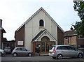
Photos of B74 3QG
Area Information
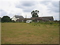
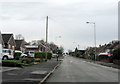
Living in B74 3QG means residing within a small, tightly clustered residential zone covering just 1.1 hectares. This specific postcode serves a concentrated population of 1471 people, creating a dense living environment that feels intimate rather than expansive. The area is part of the broader Streetly district, a semi-rural suburb located in the northern part of the Birmingham metropolitan area. Streetly sits adjacent to New Oscott, Great Barr, Four Oaks, Little Aston, and Aldridge, separated only by open fields and parts of the North Birmingham green belt. Despite its small footprint, the location benefits from strategic positioning near Sutton Park, offering direct access via a dedicated gate for local walks. The community sits on historical ground where Roman roads once ran, now preserved within nearby woodlands. While the area transformed from sparse rural land into a modern residential suburb during the mid-20th century, it retains significant open space. Residents enjoy a setting that balances suburban convenience with access to larger green areas like Sutton Park. The district acts as a quiet extension of Birmingham, offering a calm residential backdrop while remaining within commuting distance of the city centre and surrounding towns like Walsall.
- Area Type
- Postcode
- Area Size
- 1.1 hectares
- Population
- 1471
- Population Density
- 5000 people/km²
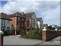
The property market in B74 3QG is distinctly characterised by long-term ownership rather than the rental market often seen in larger city centres. Home ownership rates reach 91%, demonstrating that this is a neighbourhood where residents buy to stay. The dominant accommodation type is houses, which aligns with the needs of the local population aged predominantly between 30 and 64 years. This post code area, covering only 1.1 hectares, functions as a specific residential cluster within the wider Streetly district. Buyers looking at homes in this area are entering a market where the stock is primarily privately owned and dated from the 1960s onwards. The transition of Streetly from a rural Staffordshire estate to a suburban Birmingham district in the 1950s and 1960s explains the current housing stock. Modern construction transformed the landscape, yet the area retained much of its open space and semi-rural feel. For prospective buyers, purchasing a home here means joining a community with high incumbent ownership. There are few private landlords compared to owner-occupiers. This stability often creates a more predictable market for buyers seeking a residence to own for years. Homes in this specific postcode offer a blend of suburban practicality and access to the wider greenbelt surrounding the district.
House Prices in B74 3QG
Showing 18 properties
| Address | Type | Beds | Baths | Last Sale Price | Last Sale Date | |
|---|---|---|---|---|---|---|
| 5 Northside Drive, Streetly, B74 3QG | Semi-detached | 3 | 1 | £359,000 | Nov 2023 | |
| 8 Northside Drive, Streetly, B74 3QG | Bungalow | - | - | £386,000 | Feb 2022 | |
| 15 Northside Drive, Streetly, B74 3QG | Semi-detached | 3 | 1 | £327,000 | Sep 2021 | |
| 1 Northside Drive, Streetly, B74 3QG | Bungalow | - | - | £315,000 | Mar 2021 | |
| 7 Northside Drive, Streetly, B74 3QG | Bungalow | - | - | £287,000 | Feb 2021 | |
| 10 Northside Drive, Streetly, B74 3QG | Bungalow | - | - | £265,000 | Jul 2016 | |
| 3 Northside Drive, Streetly, B74 3QG | Bungalow | - | - | £241,000 | Apr 2014 | |
| 16 Northside Drive, Streetly, B74 3QG | Semi-detached | 3 | 1 | £192,500 | Aug 2011 | |
| 19 Northside Drive, Streetly, B74 3QG | Bungalow | - | - | £212,000 | Sep 2009 | |
| 18 Northside Drive, Streetly, B74 3QG | Semi-detached | - | - | £206,000 | Mar 2007 |
Energy Efficiency in B74 3QG
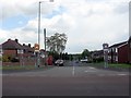
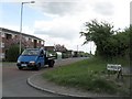
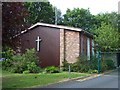
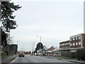
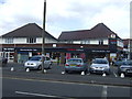
Daily life in B74 3QG is supported by a network of amenities located just minutes away. Residents have immediate access to five retail locations, including Tesco Streetly, Waitrose Little, and M&S Foley BP. These shops provide essential groceries and household goods without requiring travel to the city centre. For commuters or those preferring trains, five railway stations are within practical reach, featuring Butlers Lane, Four Oaks, and Blake Street. The five nearby Metro stops, including Winson Green Outer Circle and Handsworth Booth Street, offer further connectivity options. Beyond shopping and transport, lifestyle benefits include a strong connection to nature through Sutton Park. Streetly holds a dedicated gate into this major amenity, allowing residents to enjoy walks and outdoor activities locally. Historical landmarks contribute to the area's character, including a church built in Foley Road in 1908 and the Parson & Clerk Inn, which marks the start of the Roman Ryknield Street within the park. Community facilities such as a clinic and a library in Blackwood Road, dating from the 1960s and 1970s, serve local needs. The area feels like a quiet suburb where local shopping and easy access to green spaces form the core of the weekly routine.
Amenities
Schools
| Rank | School | Type | Entry gender | Ages |
|---|
Explore more schools in this area
Go to Schools tabDemographics
The community in B74 3QG is defined by a mature demographic profile, with a median age of 47 years. Most residents fall into the adult category, specifically those aged between 30 and 64 years, suggesting a population that has settled down or is in the middle of their working lives. Home ownership stands at a remarkably high level of 91%, indicating that the vast majority of residents purchase their properties rather than rent. The predominant accommodation type consists of houses, reinforcing the character of a family-oriented neighbourhood. The area is predominantly populated by people identifying as White, reflecting a settled, local community makeup. This demographic structure points to a stable area where long-term residents make up the core. The high rate of home ownership and the prevalence of houses suggest a market where families and established households are the primary profile. With a density of 133,509 people per square kilometre, the immediate vicinity feels populated, yet the broader district remains suburban. This concentration of adult age groups and homeowners typically correlates with schools catering to older children and professionals working flexible hours or locally.
Household Size
Accommodation Type
Tenure
Ethnic Group
Religion
Household Composition
Age
Household Deprivation
NS-SEC
Explore more demographic insights in this area
Go to Demographics tabPlanning
Planning Constraints
- Flood RiskPremium
- Ramsar Wetland SitesPremium
- Area of Outstanding Natural BeautyPremium
- Protected Nature ReservePremium
- Protected WoodlandPremium