Area Overview for B74 3NP
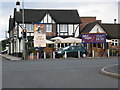
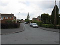
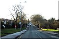
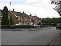
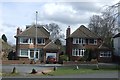
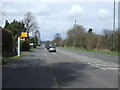
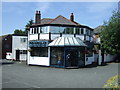
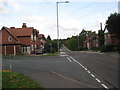
Photos of B74 3NP
Area Information
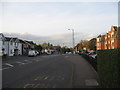
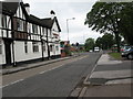
Living in B74 3NP means residing within a small, defined postcode cluster of just 1.5 hectares. This compact residential footprint supports a population of 1,524 people, creating an environment where communities often know one another. The area occupies a semi-rural to suburban district in the West Midlands, sitting on the northern edge of the Birmingham metropolitan area. You will find yourself bordered by New Oscott, Great Barr, Four Oaks, Little Aston, and Aldridge. Open fields and the North Birmingham green belt separate you from Walsall, while access to Sutton Park provides a dedicated local gate just a short walk away. Historically, this location traces its roots back to Ryknield Street, a Roman road whose line remains visible nearby. While archaeologists have found evidence of Stone Age people in the region, the modern character of B74 3NP evolved significantly after the Midland Railway Company opened Streetly Station in 1879. Though the station closed in 1965, the area transformed from a sparsely populated rural zone into a substantial residential suburb during the 1950s and 1960s. Today, you inhabit a space that balances suburban convenience with nearby green spaces, offering a quiet retreat without total isolation from the wider city.
- Area Type
- Postcode
- Area Size
- 1.5 hectares
- Population
- 1524
- Population Density
- 1828 people/km²
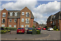
The property market in B74 3NP is defined by stability and private ownership. With 88 per cent of homes in the postcode being owner-occupied, you are looking at an area where sellers typically have a long-term stake in their properties. The accommodation type data confirms that houses are the standard, meaning you will not find the density of flats or shared living arrangements common in city centres. This structure appeals to buyers seeking traditional family homes with private gardens and established frontage. Because most residents have owned their homes through multiple life stages, the market tends to favour permanent residents over transient tenants. The total population of 1,524 living within 1.5 hectares suggests a tightly knit group where property values likely mirror the needs of families and established couples rather than single professionals looking for short-term lets. The legacy of housing development between 1918 and 1939, alongside the post-war expansion of the 1950s and 1960s, provides a diverse but consistent stock of residential properties. When searching for homes in B74 3NP, you are entering a market characterised by substantial brick-built houses rather than modern high-density blocks, fitting the semi-rural suburban character described in local research.
House Prices in B74 3NP
Showing 24 properties
| Address | Type | Beds | Baths | Last Sale Price | Last Sale Date | |
|---|---|---|---|---|---|---|
| 100 Foley Road West, Streetly, B74 3NP | Detached | 3 | 1 | £370,000 | Jul 2025 | |
| 112 Foley Road West, Streetly, B74 3NP | Semi-detached | 3 | 1 | £315,000 | Nov 2023 | |
| 90 Foley Road West, Streetly, B74 3NP | house | - | - | £470,000 | Dec 2020 | |
| 84 Foley Road West, Streetly, B74 3NP | house | - | - | £450,000 | Apr 2019 | |
| 118 Foley Road West, Streetly, B74 3NP | Bungalow | 2 | 1 | £310,000 | Nov 2018 | |
| 96 Foley Road West, Streetly, B74 3NP | Semi-detached | 3 | 1 | £318,000 | Feb 2018 | |
| 86 Foley Road West, Streetly, B74 3NP | house | - | - | £310,000 | Jun 2017 | |
| 116 Foley Road West, Streetly, B74 3NP | Detached | 5 | 2 | £430,000 | Mar 2017 | |
| 98 Foley Road West, Streetly, B74 3NP | house | - | - | £517,000 | Nov 2016 | |
| 82 Foley Road West, Streetly, B74 3NP | Detached | 4 | 1 | £431,500 | Jul 2015 |
Energy Efficiency in B74 3NP
Your daily life in B74 3NP benefits from a range of amenities located within practical reach of the residential cluster. Retail options include five nearby stores, specifically named Tesco Streetly, M&S Foley BP, and Co-op Streetly, guaranteeing you do not need to travel far for groceries or everyday goods. Connectivity to rail services is strong, with five stations accessible, including Butlers Lane and Blake Street, alongside one metro station at Wednesbury Great Western Street. These five rail and one metro options provide flexibility for your weekly trips. Nature plays a significant role in lifestyle here, highlighted by proximity to Sutton Park. The area has its own dedicated gate into the park, offering immediate access for walking or cycling. Historical sites add to the appeal, such as the church built in Foley Road in 1908 and the Parson & Clerk Inn, which marks the starting point of the Roman Ryknield Street within the park. Cultural facilities like a clinic and a library, both located in Blackwood Road, date back to the 1960s and 1970s, serving the community needs well. Living in B74 3NP means you enjoy a blend of local convenience and historical charm without the need for long journeys for essential services.
Amenities
Schools
| Rank | School | Type | Entry gender | Ages |
|---|
Explore more schools in this area
Go to Schools tabDemographics
The community in B74 3NP is dominated by adults aged between 30 and 64 years, reflecting a mature household structure typical of established suburbs. The median age for residents is 47, suggesting a population that has likely settled in the area for multiple decades. A striking 88 per cent of homes in this postcode are owner-occupied, indicating high stability and long-term residency compared to rental-dominated districts. This ownership rate aligns with the accommodation type data, which confirms that houses are the primary dwelling structure, rather than flats or terraced housing. You will find that the predominant ethnic group in B74 3NP is White, which contributes to a consistent community profile. The low density of just 1.5 hectares supporting 1,524 people results in a population density of 98,776 people per square kilometre when calculated against the specific footprint. This figure highlights that while the area feels bustling due to its high concentration within such a small boundary, the sheer volume of people remains manageable. The demographic picture presents a stable, home-owning community where families and individuals in their prime working years have invested deeply in their properties, fostering a neighbourhood with distinct local roots.
Household Size
Accommodation Type
Tenure
Ethnic Group
Religion
Household Composition
Age
Household Deprivation
NS-SEC
Explore more demographic insights in this area
Go to Demographics tabPlanning
Planning Constraints
- Flood RiskPremium
- Ramsar Wetland SitesPremium
- Area of Outstanding Natural BeautyPremium
- Protected Nature ReservePremium
- Protected WoodlandPremium