Area Overview for B71 4LQ
Photos of B71 4LQ
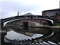
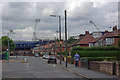


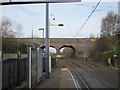
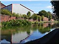


62 photos from this area
Area Information
Key information about the B71 4LQ including its size, population, and administrative classification.
- Area Type
- Postcode
- Area Size
- 1.3 hectares
- Population
- 1481
- Population Density
- 2940 people/km²
House Prices in B71 4LQ
31
Properties
£91,371
Average Sold Price
£24,700
Lowest Price
£182,000
Highest Price
Showing 31 properties
| Address | Type | Beds | Baths | Last Sale Price | Last Sale Date | |
|---|---|---|---|---|---|---|
| 173 Halfords Lane, West Bromwich, B71 4LQ | house | - | - | £182,000 | Jan 2025 | |
| 172 Halfords Lane, West Bromwich, B71 4LQ | house | - | - | £120,000 | Apr 2021 | |
| 167 Halfords Lane, West Bromwich, B71 4LQ | Terraced | 3 | 1 | £143,000 | Apr 2020 | |
| 171 Halfords Lane, West Bromwich, B71 4LQ | house | - | - | £100,000 | May 2019 | |
| 161 Halfords Lane, West Bromwich, B71 4LQ | Terraced | 3 | 1 | £125,000 | May 2019 | |
| 162 Halfords Lane, West Bromwich, B71 4LQ | Terraced | 3 | 1 | £130,000 | Jul 2018 | |
| 153 Halfords Lane, West Bromwich, B71 4LQ | Terraced | 3 | - | £128,000 | Jun 2016 | |
| 174 Halfords Lane, West Bromwich, B71 4LQ | house | - | - | £75,000 | Mar 2011 | |
| 160 Halfords Lane, West Bromwich, B71 4LQ | house | - | - | £103,500 | Feb 2007 | |
| 156 Halfords Lane, West Bromwich, B71 4LQ | house | - | - | £44,000 | Jun 2001 |
Page 1 of 4
Energy Efficiency in B71 4LQ
Amenities
Schools
| Rank | School | Type | Entry gender | Ages |
|---|
Explore more schools in this area
Go to Schools tabDemographics
Household Size
Family (3-5 people)
most common
Accommodation Type
Houses
most common
Tenure
53
majority
Ethnic Group
asian_total
most common
Religion
N/A
most common
Household Composition
N/A
most common
Age
47
median
Adults (30-64 years)
most common
Household Deprivation
N/A
with no deprivation
NS-SEC
10
in Lower managerial occupations
Explore more demographic insights in this area
Go to Demographics tabPlanning
Planning Constraints
- Flood RiskPremium
- Ramsar Wetland SitesPremium
- Area of Outstanding Natural BeautyPremium
- Protected Nature ReservePremium
- Protected WoodlandPremium