Area Overview for B71 4LF
Photos of B71 4LF


Area Information
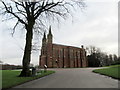
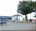
Living in B71 4LF means being part of a tightly packed residential cluster in England’s West Midlands. The area covers just 4.1 hectares, yet it holds 1,481 residents, resulting in a population density of 36,358 people per square kilometre. This compactness shapes daily life, with a strong sense of proximity to local amenities and community hubs. Historically, the area is tied to the industrial legacy of the Black Country, though today it serves as a quiet residential enclave. Its location near St. Paul’s Ward, with its 19th-century industrial roots, hints at a past defined by manufacturing, but modern life here is more about domestic stability. The area’s small size means residents are likely to know their neighbours, with a mix of older and newer homes accommodating a population skewed toward adults aged 30–64. For those seeking a place with historical depth but contemporary convenience, B71 4LF offers a unique blend of compact living and regional heritage.
- Area Type
- Postcode
- Area Size
- 4.1 hectares
- Population
- 1481
- Population Density
- 2940 people/km²
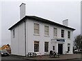
The property market in B71 4LF is characterised by a 53% home ownership rate, with houses being the primary accommodation type. This indicates a market where owner-occupation is common, though not dominant, and rental properties also play a role. The small area size—just 4.1 hectares—means the housing stock is limited, likely concentrated in older, traditional homes. Buyers should expect competition for available properties, given the area’s compact nature. The lack of high-rise or modern developments suggests a focus on single-family homes, which may appeal to those seeking a settled, low-density lifestyle. However, the limited size of the area means that property values and availability could be influenced by proximity to nearby amenities and transport links. For those considering a move, the market is likely to be niche, with properties offering a blend of historical charm and practicality.
House Prices in B71 4LF
No properties found in this postcode.
Energy Efficiency in B71 4LF
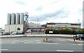
Life in B71 4LF is shaped by its proximity to essential amenities, including five retail outlets such as Spar, Farmfoods Handsworth, and Lidl Handsworth. These shops provide everyday convenience, from groceries to household goods, reducing the need for long trips. The area’s rail and metro stations, like Smethwick Rolfe Street and Trinity Way, ensure easy access to nearby towns and cities. While the data does not mention parks or leisure facilities, the presence of multiple transport hubs and retail options suggests a practical, community-focused lifestyle. Residents can enjoy a mix of local shopping and efficient travel, with the area’s small size fostering a sense of cohesion. The combination of retail, transport, and proximity to historical sites like St. Paul’s Church adds depth to daily life, blending practicality with regional heritage.
Amenities
Schools
The nearest school to B71 4LF is Sandwell Academy, an academy with a Good Ofsted rating. This institution provides a range of educational opportunities for local children, though the data does not indicate the presence of other schools in the immediate vicinity. The availability of a single academy suggests that families may need to consider commuting for secondary education, depending on their specific needs. The Good rating indicates a satisfactory standard of teaching and facilities, which is reassuring for parents seeking reliable education for their children. However, the absence of additional schools—such as primary or specialist institutions—means that families may need to look beyond the immediate area for a broader range of educational options.
| Rank | School | Type | Entry gender | Ages |
|---|
Explore more schools in this area
Go to Schools tabDemographics
The community in B71 4LF is predominantly composed of adults aged 30–64, with a median age of 47. This suggests a mature, established population, many of whom may have lived in the area for years. Home ownership rates stand at 53%, indicating a mix of owner-occupied properties and rental units. The accommodation type is primarily houses, reflecting a traditional housing stock rather than flats or apartments. The predominant ethnic group is Asian, which shapes the cultural fabric of the area. With such a high population density, daily life is likely to involve shared spaces and communal interaction. The data does not specify deprivation levels, but the high density and older housing stock may influence local services and infrastructure demands. For buyers, this profile suggests a stable, long-term community with a focus on family-oriented living.
Household Size
Accommodation Type
Tenure
Ethnic Group
Religion
Household Composition
Age
Household Deprivation
NS-SEC
Explore more demographic insights in this area
Go to Demographics tabPlanning
Planning Constraints
- Flood RiskPremium
- Ramsar Wetland SitesPremium
- Area of Outstanding Natural BeautyPremium
- Protected Nature ReservePremium
- Protected WoodlandPremium