Area Overview for B71 3BD
Photos of B71 3BD
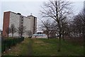
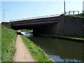
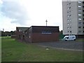


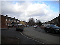

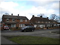

41 photos from this area
Area Information
Key information about the B71 3BD including its size, population, and administrative classification.
- Area Type
- Postcode
- Area Size
- 1.3 hectares
- Population
- 1718
- Population Density
- 5050 people/km²
House Prices in B71 3BD
26
Properties
£198,107
Average Sold Price
£68,000
Lowest Price
£480,000
Highest Price
Showing 26 properties
| Address | Type | Beds | Baths | Last Sale Price | Last Sale Date | |
|---|---|---|---|---|---|---|
| 81 Bustleholme Lane, West Bromwich, B71 3BD | house | 3 | - | £255,000 | Jan 2021 | |
| 61 Bustleholme Lane, West Bromwich, B71 3BD | Semi-detached | 3 | 1 | £290,000 | Jun 2020 | |
| 51 Bustleholme Lane, West Bromwich, B71 3BD | house | - | - | £480,000 | Jan 2019 | |
| 71 Bustleholme Lane, West Bromwich, B71 3BD | house | - | - | £220,000 | Jun 2011 | |
| 49 Bustleholme Lane, West Bromwich, B71 3BD | Detached | 5 | - | £180,000 | Apr 2010 | |
| The Galton House, 47 Bustleholme Lane, West Bromwich, B71 3BD | house | - | - | £223,000 | Apr 2010 | |
| 75 Bustleholme Lane, West Bromwich, B71 3BD | Semi-detached | - | - | £185,000 | Nov 2009 | |
| 79 Bustleholme Lane, West Bromwich, B71 3BD | house | - | - | £177,000 | May 2009 | |
| 73 Bustleholme Lane, West Bromwich, B71 3BD | Semi-detached | 4 | 2 | £227,000 | May 2007 | |
| 55 Bustleholme Lane, West Bromwich, B71 3BD | Semi-detached | - | - | £208,000 | Mar 2007 |
Page 1 of 3
Energy Efficiency in B71 3BD
Amenities
Schools
| Rank | School | Type | Entry gender | Ages |
|---|
Explore more schools in this area
Go to Schools tabDemographics
Household Size
Family (3-5 people)
most common
Accommodation Type
Houses
most common
Tenure
73
majority
Ethnic Group
White
most common
Religion
N/A
most common
Household Composition
N/A
most common
Age
47
median
Adults (30-64 years)
most common
Household Deprivation
N/A
with no deprivation
NS-SEC
24
in Lower managerial occupations
Explore more demographic insights in this area
Go to Demographics tabPlanning
Planning Constraints
- Flood RiskPremium
- Ramsar Wetland SitesPremium
- Area of Outstanding Natural BeautyPremium
- Protected Nature ReservePremium
- Protected WoodlandPremium